Grand Marais, Michigan
| Grand Marais | |
|---|---|
| Unincorporated Community | |
 | |
| Motto(s): Eastern Gateway to Pictured Rocks National Lakeshores[1] | |
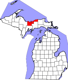
 Grand Marais Location within the state of Michigan | |
| Coordinates: 46°40′15″N 85°59′07″W / 46.67083°N 85.98528°WCoordinates: 46°40′15″N 85°59′07″W / 46.67083°N 85.98528°W | |
| Country | United States |
| State | Michigan |
| County | Alger |
| Township | Burt Township |
| Elevation | 627 ft (191 m) |
| Population (2000) | |
| • Total | 350 |
| Time zone | UTC-5 (Eastern (EST)) |
| • Summer (DST) | UTC-4 (EDT) |
| Website | http://www.grandmaraismichigan.com/ |
Grand Marais is an unincorporated community in Burt Township, Alger County in the U.S. state of Michigan. It is located on Lake Superior, and is the eastern gateway to the Pictured Rocks National Lakeshore via H-58.
History

The name Grand Marais (French: great marsh) is a reference to the large, shallow harbor. French explorers used the word "marais" to mean "harbor of refuge" as well as "marsh."
A breakwater was later built that extends from the bay into Lake Superior. The Grand Marais Outer Range Light is at its end,[2] and the Fresnel lens is still operative. It is one of only 70 such lenses that remain operational in the United States; 16 of these are in use on the Great Lakes, eight of which are in Michigan.[3] Many controversies in the little town relate to the costs of dredging and breakwall-repair operations to keep the harbor functioning.
Grand Marais was one of five U.S. Life-Saving Service Stations established along the coast of Lake Superior between Munising and Whitefish Point in the Upper Peninsula of Michigan. It was part of the U.S. Life-Saving Service District 10 (later part of District 11). The other four Life-saving Stations were Deer Park, Two Heart, Crisp Point Light, and Vermilion Point. In 1915, these stations became part of the U.S. Coast Guard. In 1939 the U.S. Lighthouse Service also merged under the control of the U.S. Coast Guard.
The community was home to the Grand Marais Air Force Station from 1954 to 1957. The station was part of the Air Defense Command, and provided general surveillance radar along the northern frontier of the United States.
Geography
Grand Marais is the northern terminus of M-77.[4] Seney and the Seney National Wildlife Refuge are to the south.
Arts and culture

Grand Marais is a four-season tourist destination. Snowmobiling is popular in the winter, and swimming, boating, kayaking, and fishing are among the summer activities.
Points of interest and events include:
- The former United States Coast Guard Life-Saving Station, which now serves as a ranger station. The Coast Guard radio operator here had the last communication with the SS Edmund Fitzgerald before she sank during a storm in 1975, with all hands lost.[5] The former keeper's quarters of the station were adapted to house the Grand Marais Maritime Museum.
- The Pickle Barrel House Museum (1926).
- The Au Sable Light, which is listed on the National Register of Historic Places.
- Muskallonge Lake State Park.
- Sable Falls, west of Grand Marais.
- The Gitche Gumee Agate and History Museum.[6]
- The Lake Superior Brewing Company operates a brewery and pub at Grand Marais.[7]
- In mid June, the harbor at Grand Marais is the site of the annual sea plane fly-in, hosted by the Grand Marais Pilots Association on behalf of the National Seaplane Pilots Association.[8]
- In mid July, the Great Lakes Sea Kayak Symposium is held at the harbor. This multi-day event attracts sea kayakers from around the country. It is billed as "the largest and oldest sea kayaking symposium on the Great Lakes."[9]
Education
Burt Township Schools is the local school district.[10]
We Hear You America contest
Grand Marais, with a population of about 300, gained national attention[11] early in 2011 when it became the leader in a national contest sponsored by Reader's Digest. Visitors to the We Hear You America web site had the opportunity to "cheer" for any community in order to win recognition and cash prizes.[12] Grand Marais' harbor was officially deemed a Harbor of Refuge because it was the only lifeline a sailor had along the dangerous shipwreck coast of Lake Superior. Years of neglect had caused deterioration of its harbor breakwall, allowing sand to fill in, but the cost to repair it seemed prohibitive.[13] Grand Marais attained 1,281,724 "cheers" and won the top municipal first prize of $40,000 in the contest, as well as notoriety for its plight in a Reader's Digest article.[11]
Transportation
Grand Marais Airport is a general aviation airport.
See also
References
- ↑ "Grand Marais Chamber of Commerce website". Grand Marais Chamber of Commerce.
- ↑ Terry Pepper, "Seeing the Light, Grand Marais Light".
- ↑ United States Coast Guard, Fresnel Lenses Still in Operation.
- ↑ "Michigan highway ends, M-77 picture". state-ends.com. Archived from the original on 2008-05-23.
- ↑ "Hunt's Guide to the Upper Peninsula", Grand Marais Maritime Museum.
- ↑ "Home Page". Gitche Gumee Agate and History Museum. Retrieved May 2015. Check date values in:
|accessdate=(help) - ↑ "Pure Michigan, Grand Marais", Michigan State
- ↑ "Sea Planes Splash-In, Grand Marais, MI". grandmaraismichigan.com. Archived from the original on 2011-10-03.
- ↑ "Great Lake Sea Kayak Symposium". Downwind sports.
- ↑ "Contact Us." Burt Township Schools. Retrieved on July 21, 2018. "Burt Township Schools 27 Colwell Ave P.O. Box 338 Grand Marais, MI 49839"
- 1 2 Staff. "Grand Marais Wins Contest". The Evening News. Sault Ste. Marie, Michigan. Archived from the original on February 16, 2011. Retrieved June 7, 2011.
- ↑ We Hear you America Archived 2011-02-06 at the Wayback Machine.
- ↑ "Grand Marais Harbor & Breakwall Restoration Project". saveyourharbor.com. Archived from the original on 2011-01-28.
External links
- Grand Marais Website
- Grand Marais Historical Society
- 2nd Grand Marais Website
- USCG Auxiliary Flotilla 26-12
- Terry Pepper, Seeing the Light, Grand Maris Light.
- Pictured Rocks National Lakeshore Maritime Sites
- U.S. Coast Guard Search & Rescue Index
- Grand Marais on Michigan Out of Doors TV
- Alger County Sheriff's Office