Graham, Kentucky
| Graham | |
|---|---|
| CDPs | |
 Graham Location within the state of Kentucky  Graham Graham (the US) | |
| Coordinates: 37°14′15″N 87°16′48″W / 37.23750°N 87.28000°WCoordinates: 37°14′15″N 87°16′48″W / 37.23750°N 87.28000°W | |
| Country | United States |
| State | Kentucky |
| County | Muhlenberg |
| Elevation | 528 ft (161 m) |
| Time zone | UTC-6 (Central (CST)) |
| • Summer (DST) | UTC-5 (CST) |
| ZIP codes | 42344 |
| Area code(s) | 270 |
| GNIS feature ID | 2629623[1] |
Graham is a census-designated place (CDP) located in Muhlenberg County, Kentucky, United States.
A post office was established in the community in 1904.[2] Graham was named for William Graham Duncan, the Scottish-American owner of the W. G. Duncan Coal Company for which the coal town was built.[3][4]
References
- ↑ U.S. Geological Survey Geographic Names Information System: Graham, Kentucky
- ↑ "Muhlenberg County". Jim Forte Postal History. Retrieved 16 April 2015.
- ↑ Rennick, Robert M. (1987). Kentucky Place Names. University Press of Kentucky. p. 121. Retrieved 2013-04-28.
- ↑ Anderson, Bobby (September 19, 2007). "Sandy Called These Names". Leader-News. pp. A12. Retrieved 16 May 2015.
Municipalities and communities of Muhlenberg County, Kentucky, United States | ||
|---|---|---|
| Cities | 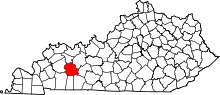 | |
| CDPs | ||
| Unincorporated communities | ||
| Ghost town | ||
| Footnotes | ‡This populated place also has portions in an adjacent county or counties | |
This article is issued from
Wikipedia.
The text is licensed under Creative Commons - Attribution - Sharealike.
Additional terms may apply for the media files.