Grade I listed buildings in Hambleton
There are over 9,000 Grade I listed buildings in England. This page is a list of these buildings in the district of Hambleton in North Yorkshire.
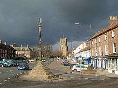
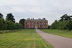
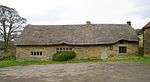
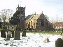
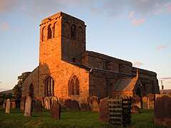
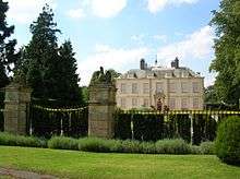
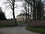
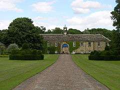
Hambleton
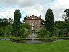
Apr2007.jpg)


Notes
- ↑ The date given is the date used by Historic England as significant for the initial building or that of an important part in the structure's description.
- ↑ Sometimes known as OSGB36, the grid reference is based on the British national grid reference system used by the Ordnance Survey.
- ↑ The "List Entry Number" is a unique number assigned to each listed building and scheduled monument by Historic England.
References
- ↑ Historic England. "Details from image database (332139)". Images of England. Retrieved 17 January 2009.
- ↑ Historic England. "Details from image database (333349)". Images of England. Retrieved 29 September 2010.
- 1 2 3 "Conservation Area Assessment: Bedale" (pdf). Hambleton District Council. October 1998. p. 7. Retrieved 16 January 2009.
- ↑ Historic England. "Details from image database (333548)". Images of England. Retrieved 16 January 2009.
- ↑ Historic England. "Details from image database (333539)". Images of England. Retrieved 16 January 2009.
- ↑ Historic England. "Details from image database (332094)". Images of England. Retrieved 16 January 2009.
- ↑ "Spout House:LBS no:1150636". Heritagegateway. Retrieved 7 December 2015.
- ↑ Historic England. "Details from image database (332379)". Images of England. Retrieved 17 January 2009.
- ↑ Historic England. "Details from image database (332636)". Images of England. Retrieved 17 January 2009.
- ↑ "Cowling Hall And Wing:LBS Number 1294034". heritagegateway. Retrieved 17 January 2009.
- ↑ "Church Of St Michael:LBS Number 332747". heritagegateway. Retrieved 18 January 2009.
- ↑ "Shandy Hall:LBS Number 332739". heritagegateway. Retrieved 18 January 2009.
- ↑ "Church Of St Peter:LBS Number 332752". heritagegateway. Retrieved 18 January 2009.
- ↑ "Danby Wiske Church:LBS Number 332049". heritagegateway. Retrieved 18 January 2009.
- ↑ "Mount Grace Priory:LBS Number 332435". heritagegateway. Retrieved 18 January 2009.
- ↑ "Church Of All Saints:LBS Number 332998". heritagegateway. Retrieved 20 January 2009.
- ↑ "Arncliffe Hall:LBS Number 332063". heritagegateway. Retrieved 18 January 2009.
- ↑ "Church Of St Andrew:LBS Number 333146". heritagegateway. Retrieved 20 January 2009.
- ↑ "Kiplin Hall:LBS Number 332063". heritagegateway. Retrieved 17 January 2009.
- ↑ "Dromonby Hall & Cottage with Outbuilding:LBS Number 333205". heritagegateway. Retrieved 18 January 2009.
- ↑ "Church Of St Michael:LBS Number 332658". heritagegateway. Retrieved 18 January 2009.
- ↑ Historic England. "Details from image database (332170)". Images of England. Retrieved 16 January 2009.
- ↑ Historic England. "Details from image database (333390)". Images of England. Retrieved 17 January 2009.
- ↑ "Myton Hall:LBS Number 333389". heritagegateway. Retrieved 18 January 2009.
- ↑ "Newburgh Priory:LBS Number 332765". heritagegateway. Retrieved 18 January 2009.
- ↑ "Church Of All Saints:LBS Number 332798". heritagegateway. Retrieved 20 January 2009.
- ↑ "Church of All Saints:LBS Number 331931". heritagegateway. Retrieved 18 January 2009.
- ↑ "Snape Castle:LBS Number 333605". heritagegateway. Retrieved 20 January 2009.
- ↑ "Church of St Mary:LBS Number 332075". heritagegateway. Retrieved 18 January 2009.
- ↑ "Cowton Castle:LBS Number 332070". heritagegateway. Retrieved 17 January 2009.
- ↑ "Sutton Park:LBS Number 440945". heritagegateway. Retrieved 18 January 2009.
- ↑ "Allerthorpe Hall:LBS Number 332663". heritagegateway. Retrieved 17 January 2009.
- ↑ "Allerthorpe Hall:LBS Number 332664". heritagegateway. Retrieved 18 January 2009.
- ↑ "Thornton Watlass Hall & Stable Block:LBS Number 333616". heritagegateway. Retrieved 18 January 2009.
- ↑ "Church Of St Michael:LBS Number 332669". heritagegateway. Retrieved 18 January 2009.
- ↑ "The Hall:LBS Number 332673". heritagegateway. Retrieved 18 January 2009.
- ↑ "Church Of St Nicholas:LBS Number 332680". heritagegateway. Retrieved 18 January 2009.
- ↑ "The Marmion Tower:LBS Number 332681". heritagegateway. Retrieved 18 January 2009.
- ↑ "Old Church Of Holy Rood:LBS Number 333236". heritagegateway. Retrieved 20 January 2009.
- ↑ "Whorlton Castle Gatehouse:LBS Number 333224". heritagegateway. Retrieved 20 January 2009.
External links
![]()
This article is issued from
Wikipedia.
The text is licensed under Creative Commons - Attribution - Sharealike.
Additional terms may apply for the media files.