Carpathian Ruthenia during World War II
| Governorate of Subcarpathia Kárpátaljai Kormányzóság[1] | ||||||
| Region of the Kingdom of Hungary | ||||||
| ||||||
| ||||||
 | ||||||
| Capital | Ungvár[2] | |||||
| Government | Military, later civil administration | |||||
| Regent's Commissioner | ||||||
| • | 1939–1940 | Zsigmond Perényi | ||||
| • | 1940–1941 | Miklós Kozma | ||||
| • | 1942–1944 | Vilmos Pál Tomcsányi | ||||
| • | 1944 | András Vincze | ||||
| Historical era | World War II | |||||
| • | Occupation | 15–18 March 1939 | ||||
| • | Military administration | 18 March 1939[3] | ||||
| • | Slovak–Hungarian War | 23–31 March 1939 | ||||
| • | Annexation | 23 June 1939[4] | ||||
| • | Civil administration | 7 July 1939[5] | ||||
| • | Military operational zone | 1 April 1944[6] | ||||
| • | Soviet invasion | 2–28 October[7] 1944 | ||||
| • | Paris Peace Treaty | 10 February 1947 | ||||
| Area | ||||||
| • | 1941 [8] | 11,583 km2 (4,472 sq mi) | ||||
| Population | ||||||
| • | 1941 [8] | 621,916 | ||||
| Density | 53.7 /km2 (139.1 /sq mi) | |||||
| Political subdivisions | Administrative delegations[9]
| |||||
| Today part of | ||||||
.svg.png)
.svg.png)
Carpathian Ruthenia was a region in the easternmost part of Czechoslovakia (Subcarpathian Ruthenia, or Transcarpathia) that became autonomous within that country in September 1938, declared its independence as the "Republic of Carpatho-Ukraine” in March 1939, was immediately occupied and annexed by Hungary, invaded by the Soviet Red Army in 1944 and incorporated into the Ukrainian Soviet Socialist Republic in 1946.
Independence and annexation by Hungary
In November 1938, under the First Vienna Award which resulted from the Munich Agreement, Nazi Germany and Fascist Italy prevailed on the Second Czechoslovak Republic to cede the southern third of Slovakia and southern Carpathian Ruthenia to the Kingdom of Hungary. Between 14 March and 15 March 1939, the Slovak Republic declared its independence and Nazi Germany occupied Bohemia and Moravia creating the Protectorate of Bohemia and Moravia. On 15 March, Carpatho-Ukraine declared its independence as the Republic of Carpatho-Ukraine, with the Reverend Avhustyn Voloshyn as head of state. Hungary immediately occupied and annexed the new republic. On 18 March, resistance to the invasion ended. On 23 March Hungary annexed further parts of eastern Slovakia west of Carpatho-Rus.
Soviet occupation
In October 1944, Carpathian Ruthenia was taken by the Soviets. A Czechoslovak delegation under František Němec was dispatched to the area. The delegation was to mobilize the liberated local population to form a Czechoslovak army and to prepare for elections in cooperation with recently established national committees.
Loyalty to a Czechoslovak state was tenuous in Carpathian Ruthenia. The Czechoslovak government-in-exile led by President Edvard Beneš issued a proclamation in April 1944 excluding from political participation former collaborationist Hungarians, Germans, and the Russophile Ruthenian followers of Andrej Brody and the Fencik Party (who had collaborated with the Hungarians). This amounted to approximately one-third of the population. Another one-third was communist, leaving one-third of the population presumably sympathetic to the Czechoslovak Republic.
Ukrainian Soviet Socialist Republic
Upon arrival in the territory, the Czechoslovak delegation set up headquarters in Khust and on 30 October issued a mobilization proclamation. Soviet military forces prevented both the printing and the posting of the Czechoslovak proclamation and proceeded instead to organize the local population. Protests from Beneš's government-in-exile went unheeded. Soviet activities led much of the local population to believe that Soviet annexation was imminent. The Czechoslovak delegation was also prevented from establishing a cooperative relationship with the local national committees promoted by the Soviets.
On 19 November, the communists, meeting in Mukachevo, issued a resolution requesting separation of the territory and the incorporation into the Ukrainian Soviet Socialist Republic. On November 26, the Congress of National Committees unanimously accepted the resolution of the communists. The Congress elected the National Council and instructed that a delegation be sent to Moscow to discuss union. The Czechoslovak delegation was asked to leave the area.
Negotiations between the Czechoslovak government and Moscow ensued. Both Czech and Slovak communists encouraged Beneš to resign on the territory. The Soviet Union agreed to postpone annexation until the postwar period to avoid compromising Beneš's policy based on the pre-Munich frontiers.
After World War II, in June 1945, Czechoslovakia and the Soviet Union signed a treaty ceding Carpathian-Ruthenia to the Soviets. The inhabitants - Czechs, Slovaks and Rusyns - were given the choice of Czechoslovak or Soviet citizenship. In 1946 the area became part of the Ukrainian Soviet Socialist Republic, as the Zakarpattia Oblast ('Transcarpathian Oblast').
Impact on Hungarian population
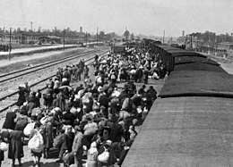
The end of the war was a cataclysm for the ethnic Hungarian population of the area: 10,000 fled before the arrival of Soviet forces. Many of the remaining adult men (25,000) were deported to the Soviet Union; about 30% of them died in Soviet gulags. As a result of war losses, emigration and extermination of Hungarian Jews, the Hungarian-speaking population of Carpathian Ruthenia decreased from 161,000 in 1941 (Hungarian census) to 66,000 in 1947 (Soviet census); the low 1947 number is doubtless in part a result of Hungarians' fear to declare their true nationality.
See also
- Bojko
- Carpathian Ruthenia
- Carpatho-Ukraine
- History of the Jews in Carpathian Ruthenia
- History of Ukraine
- Hucul
- Lech, Czech and Rus
- Lemko
- Pannonian Rusyn language
- Places inhabited by Rusyns
- Red Ruthenia
- Ruritania
- Rusyn language
- Rusyns
- Ruthenian (disambiguation)
- Ruthenian Catholic Church
- Ruthenian language
- Ruthenians
- Ruthenians and Ukrainians in Czechoslovakia (1918-1938)
- Ruthenian Voivodship
- Shlakhtov Ruthenians
- Subcarpathian Voivodship
- West Ukrainian People's Republic
- Zakarpattia Oblast
References
- ↑ Fedinec, Csilla (2010). "A kárpátaljai autonómia kérdése - Teleki Pál kísérlete" [The question of Subcarpathian autonomy - Pál Teleki's attempt]. Kárpátalja, 1919-2009: történelem, politika, kultúra [Subcarpathia, 1919-2009: history, politics, culture] (PDF) (in Hungarian). Budapest: Argumentum - MTA Etnikai-nemzeti Kisebbségkutató Intézete. p. 163. ISBN 978-963-446-596-6.
- ↑ "A m. kir. minisztérium 1939. évi 6.200. M. E. számú rendelete, a Magyar Szent Koronához visszatért kárpátaljai terület közigazgatásának ideiglenes rendezéséről" [Order No. 6.200/1939. M. E. of the Royal Hungarian Ministry on the provisional administration of the Subcarpathian territory returned to the Hungarian Holy Crown]. Magyarországi Rendeletek Tára (in Hungarian). Budapest: Magyar Királyi Belügyminisztérium. 73: 855. 1939.
- ↑ Fedinec, Csilla (2002). "A Kárpátaljai Kormányzóság idõszaka" [The period of the Governorate of Subcarpathia]. A kárpátaljai magyarság történeti kronológiája, 1918-1944 [Historical chronology of the Hungarians in Subcarpathia, 1918-1944] (PDF) (in Hungarian). Galánta - Dunaszerdahely: Fórum Intézet - Lilium Aurum Könyvkiadó. p. 322. ISBN 80-8062-117-9.
- ↑ "1939. évi VI. törvénycikk a Magyar Szent Koronához visszatért kárpátaljai területeknek az országgal egyesítéséről" [Law VI of 1939 on the unification of the Subcarpathian territories returned to the Hungarian Holy Crown with the country]. Ezer év törvényei (in Hungarian).
- ↑ Fedinec, Csilla (2002). "A Kárpátaljai Kormányzóság idõszaka" [The period of the Governorate of Subcarpathia]. A kárpátaljai magyarság történeti kronológiája, 1918-1944 [Historical chronology of the Hungarians in Subcarpathia, 1918-1944] (PDF) (in Hungarian). Galánta - Dunaszerdahely: Fórum Intézet - Lilium Aurum Könyvkiadó. p. 336. ISBN 80-8062-117-9.
- ↑ "A m. kir. minisztérium 1944. évi 1.440. M. E. számú rendelete, az ország területének egy részén a különleges közigazgatási szabályok életbeléptetéséről" [Order No. 1.440/1944. M. E. of the Royal Hungarian Ministry on the promulgation of special administrative rules on parts of the country]. Magyarországi Rendeletek Tára (in Hungarian). Budapest: Magyar Királyi Belügyminisztérium. 78: 428. 1944.
- ↑ "A kárpátaljai magyar és német polgári lakosság tömeges elhurcolása szovjet hadifogságba" [The deportation of masses of Hungarian and German civilians from Subcarpathia to Soviet prisoner of war camps]. Orpheus Noster (in Hungarian). Budapest: Károli Gáspár Református Egyetem. 4 (2): 46–47. 2012.
- 1 2 Thirring, Lajos (1942). "Vármegyéink területe, népességfejlődése, népsűrűsége és közigazgatási felosztása" [Territory, population increase and density, and administrative divisions of our counties]. Magyar Statisztikai Szemle (in Hungarian). Budapest: Magyar Királyi Központi Statisztikai Hivatal. 20 (4): 179.
- ↑ "A m. kir. belügyminiszter 1939. évi 14.500. számú rendelete, a visszatért kárpátaljai területen a községnevek megállapításáról, továbbá a közigazgatási kirendeltségek és a járások területi beosztásáról" [Order No. 14.500/1939. of the Royal Hungarian Minister of the Interior on the determination of municipality names and the territorial divisions of the administrative delegations and districts of the reincorporated Subcarpathian territory]. Magyarországi Rendeletek Tára (in Hungarian). Budapest: Magyar Királyi Belügyminisztérium. 73: 1002–1003. 1939.