Newton Township, Mackinac County, Michigan
| Newton Township, Michigan | |
|---|---|
| Township | |
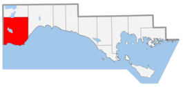 Location within Mackinac County | |
 Newton Township, Michigan Location within the state of Michigan | |
| Coordinates: 46°4′46″N 85°42′23″W / 46.07944°N 85.70639°WCoordinates: 46°4′46″N 85°42′23″W / 46.07944°N 85.70639°W | |
| Country | United States |
| State | Michigan |
| County | Mackinac |
| Area | |
| • Total | 154.9 sq mi (401.2 km2) |
| • Land | 148.6 sq mi (384.9 km2) |
| • Water | 6.3 sq mi (16.3 km2) |
| Elevation | 755 ft (230 m) |
| Population (2000) | |
| • Total | 356 |
| • Density | 2.4/sq mi (0.9/km2) |
| Time zone | UTC-5 (Eastern (EST)) |
| • Summer (DST) | UTC-4 (EDT) |
| ZIP code |
49820 (Curtis, 49827 (Engadine, 49838 (Gould City) |
| FIPS code | 26-57640[1] |
| GNIS feature ID | 1626805[2] |

Newton Township is a civil township of Mackinac County in the U.S. state of Michigan. As of the 2000 census, the township population was 356.
Communities
The township hall is in Gould City, an unincorporated community just south of US 2 at 46°05′43″N 85°41′48″W / 46.09528°N 85.69667°W.[3] It was founded in 1886 by Samuel Stites, a grocer and lumberman, who named it for another lumberman. It was also a station on the Minneapolis, St. Paul and Sault Ste. Marie Railroad. A post office was established in September 1888.[4] The ZIP code for Gould City, 49838, serves most of the southern portion of the township.[5]
- Bryan was founded in 1905 as the railroad stop for the Escanaba Lumber Company. A village was laid out next to the railroad stop by William P. Bryan. It had a post office from 1906 until 1920. By that year lumbering operations in the area had ended, and within a decade the place was entirely abandoned.[4]
- Corinne was a lumbering settlement and station on the Minneapolis, St. Paul and Sault Ste. Marie Rairoald. It had a post office from 1889 until 1942 named Viola.[6]
- Engadine is to the northeast, and the Engadine ZIP code, 49827, serves the northeast corner of the township.[7]
- Curtis is to the north and the Curtis ZIP code, 49820, serves an area in the north central part of the township.[8]
Geography
According to the United States Census Bureau, the township has a total area of 154.9 square miles (401.2 km²), of which 148.6 square miles (384.9 km²) is land and 6.3 square miles (16.3 km²) (4.06%) is water.
Demographics
As of the census[1] of 2000, there were 356 people, 170 households, and 108 families residing in the township. The population density was 2.4 per square mile (0.9/km²). There were 377 housing units at an average density of 2.5 per square mile (1.0/km²). The racial makeup of the township was 91.01% White, 7.02% Native American, and 1.97% from two or more races.
There were 170 households out of which 15.9% had children under the age of 18 living with them, 57.6% were married couples living together, 5.3% had a female householder with no husband present, and 35.9% were non-families. 28.8% of all households were made up of individuals and 11.8% had someone living alone who was 65 years of age or older. The average household size was 2.09 and the average family size was 2.53.
In the township the population was spread out with 16.3% under the age of 18, 4.8% from 18 to 24, 21.6% from 25 to 44, 32.9% from 45 to 64, and 24.4% who were 65 years of age or older. The median age was 49 years. For every 100 females, there were 98.9 males. For every 100 females age 18 and over, there were 104.1 males.
The median income for a household in the township was $26,477, and the median income for a family was $33,125. Males had a median income of $31,875 versus $19,375 for females. The per capita income for the township was $22,053. About 8.4% of families and 12.6% of the population were below the poverty line, including 8.9% of those under age 18 and 8.1% of those age 65 or over.
Transportation
Indian Trails provides daily intercity bus service via Gould City between St. Ignace and Ironwood, Michigan.[9]
References
Notes
- 1 2 "American FactFinder". United States Census Bureau. Retrieved 2008-01-31.
- ↑ U.S. Geological Survey Geographic Names Information System: Newton Township, Mackinac County, Michigan
- ↑ U.S. Geological Survey Geographic Names Information System: Gould City, Michigan
- 1 2 Romig 1986, p. 84.
- ↑ 49838 5-Digit ZCTA, 498 3-Digit ZCTA - Reference Map - American FactFinder, U.S. Census Bureau, 2000 census
- ↑ Romig 1986, p. 134.
- ↑ 49827 5-Digit ZCTA, 498 3-Digit ZCTA - Reference Map - American FactFinder, U.S. Census Bureau, 2000 census
- ↑ 49820 5-Digit ZCTA, 498 3-Digit ZCTA - Reference Map - American FactFinder, U.S. Census Bureau, 2000 census
- ↑ "ST. IGNACE-SAULT STE. MARIE-IRONWOOD" (PDF). Indian Trails. January 15, 2013. Archived from the original (PDF) on July 4, 2014. Retrieved 2013-02-28.
Sources
- Romig, Walter (October 1, 1986) [1973]. Michigan Place Names: The History of the Founding and the Naming of More Than Five Thousand Past and Present Michigan Communities. Great Lakes Books Series (Paperback). Detroit, Michigan: Wayne State University Press. ISBN 978-0-8143-1838-6.
Municipalities and communities of Mackinac County, Michigan, United States | ||
|---|---|---|
| Cities | 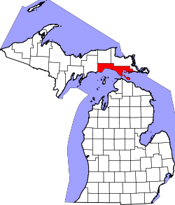 | |
| Townships | ||
| Unincorporated communities | ||