Gotovuša
- for the village in Montenegro see Gotovuša, Montenegro
| Gotovuša Готовуша | |
|---|---|
| Settlement | |
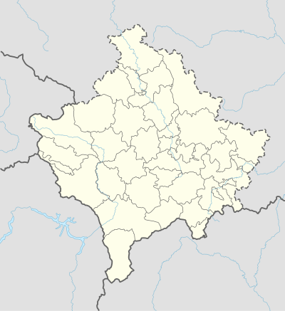 Gotovuša Location in Kosovo | |
| Coordinates: 42°14′55″N 21°4′22″E / 42.24861°N 21.07278°ECoordinates: 42°14′55″N 21°4′22″E / 42.24861°N 21.07278°E | |
| Country | Kosovo[lower-alpha 1] |
| District | District of Ferizaj |
| Municipality | Štrpce |
| First mention | 1455 |
| Area | |
| • Total | 62.2 sq mi (161.1 km2) |
| Elevation | 3,491 ft (1,064 m) |
| Population (1991) | |
| • Total | 986 |
| Time zone | UTC+1 (CET) |
| • Summer (DST) | UTC+2 (CEST) |
| Area code(s) | +381 290 |
| Car plates | 05 |
Gotovuša (Serbian Cyrillic: Готовуша) is a settlement in the Štrpce municipality in Kosovo.[lower-alpha 1] It is inhabited by ethnic Serbs,[1] according to the 1991 census, it had 986 inhabitants. The village houses two churches, protected by the Republic of Serbia.
Geography
It is situated in the northeastern part of the Šar Mountains, and in the drainage basin of the Lepenac river.
History
In Medieval Serbia, the župa (province) of Sirinić (first mentioned in 1331, in a charter of Emperor Stephen Dušan) existed, covering the whole of modern Štrpce municipality, having two cities, Gradište (in Brezovica) and Zidinac (in Gotovuša). Several remains of Byzantine forts exist in the region.[2]
Gotovuša is mentioned for the first time in an Ottoman defter (tax register) of 1455, as a great village with 64 Serb houses, and an Orthodox priest. The Church of Saint Nicholas was built here in the mid-16th-century, and is currently under protection of the Republic of Serbia as part of the Monuments of Culture of Exceptional Importance (Cultural Heritage of Serbia-list, SK 1422), in the Churches of Sirinićka župa-group.[3][4][5] The second church in Gotovuša is dedicated to the Entry of the Most Holy Theotokos (Uspenja Presvete Bogorodice), built in 1557.[6] Above the village, near the old fort of Zidinac, there are remains of several older churches. The village is part of the ecclesiastical jurisdiction of the Serbian Orthodox Eparchy of Raška and Prizren.
In 1894, the village had 87 houses, all ethnic Serb.[7]
According to data from 1938, the village had the following kin families, with their number of houses, traditions (Krsna Slava, patron saint day), and history:[8][9]
- Bugarkin (4 houses, Slava of Sv. Petka), indigenous. A male ancestor married a Bulgarian wife on pečalba (seasonal migrational work), hence their surname (meaning "of the [female] Bulgarian").
- Kosmoćević (18 houses, Sv. Petka).
- Đurđević and Kućanović (18 houses, Sv. Petka).
- Kevkić (25 houses) and Toroćev (23 houses), both with the Slava of Sv. Nikole, settled in the end of the 18th century from the village of Seroja, near Skadar. The Kevkić family heads were, in chronological manner starting from the nearest: Dobrosav (aged 90 in 1938), Simeon, Milenko, Stevan.
- Projčević (2 houses, Sv. Nikole), settled from Polog. Before their arrival, they had the Slava of Sv. Arhanđela, but as they were the only ones in the village with that Slava, and poor, they could not continue with having guests, so they changed their Slava to Sv. Nikole, which some other families had as Slava.
- Stojčević (8 houses, Sv. Arhanđeo), also settled from Polog.
- Čantrić (24 houses, Sv. Petka), settled from Semanje near Kaçanik around 1830. They hail from Burnik near Ferizaj.
| Ethnic group | 1948 | 1953 | 1961 | 1971 | 1981[10] | 1991 |
|---|---|---|---|---|---|---|
| Serbs | 971 (98,58%) | |||||
| Others | 14 (1,42%) | |||||
| Total[11] | 697 | 779 | 839 | 906 | 985 | 986 |
Infrastructure
The settlement is in the territory of a cadastre of 1611 hectares. The village has a primary school, "Рајко Урошевић".[12]
Annotations
- 1 2 Kosovo is the subject of a territorial dispute between the Republic of Kosovo and the Republic of Serbia. The Republic of Kosovo unilaterally declared independence on 17 February 2008, but Serbia continues to claim it as part of its own sovereign territory. The two governments began to normalise relations in 2013, as part of the Brussels Agreement. Kosovo has received formal recognition as an independent state from 113 out of 193 United Nations member states.
References
- ↑ Republic of Serbia, Министарствo за Косово и Метохију, Општина Штрпце
- ↑ Rastko
- ↑ SANU, National Center for Digitization, Cultural Monuments in Serbia: Crkva Sv. Nikole
- ↑ Šuput 1991, p. 59
- ↑ Historic Monuments of Kosovo and Metohija, Autonomous Province of Republic of Serbia (Districs: Pec,, Prizren, and Pristina), #10
- ↑ SANU, National Center for Digitization, Cultural Monuments in Serbia: Crkva Sv. Bogorodice
- ↑ Branislav Đ Nušić, S Kosova na sinje more: beleške s puta kroz Arbanase 1894. godine, Čigoja štampa, 2005, p. 18
- ↑ Podaci „Naselja“ (dr. A. Urošević: Šarplaninska Župa Sirinić)
- ↑ Annuaire, Volume 1, Univerzitet vo Skopje. Prirodno-matematički oddel, Oddel, Jan 1, 1948, p. 174
- ↑ 1981 Census, Kosovo Archived 2012-03-17 at the Wayback Machine.
- ↑ Kosovo censuses 1948–1991
- ↑ Republic of Serbia, Službeni glasnik Republike Srbije, Issues 87–99, Jan 1, 2004
- Marica Šuput, Spomenici srpskog crkvenog graditeljstva, XVI-XVII vek, Institut za istoriju umetnosti, Filozofski fakultet, 1991
External links
- Bele poklade, Gotovusa; feast in Serbian Orthodox pre-Easter tradition (Video)
| Town | Štrpce |  |
|---|---|---|
| Villages | ||
| Landmarks | ||