Goswell Road
Goswell Road is a road in central London. The road forms part of the A1. The southern part of the road is located in the City of London, it continues north into to the London Borough of Islington through Clerkenwell, crossing Old Street ending at Angel.
All of the road is inside the Central London congestion charge zone.
Notable places along the road include the main campus of City University to the west and the Headquarters of DB Schenker Rail (UK) at 310 Goswell Road.
London Bus routes 4 and 56 serve Goswell Road.
Toponomy
There is dispute over the origins of the name, with some sources claiming the road was named after a nearby garden called 'Goswelle' or 'Goderell' which belonged to Robert de Ufford, 1st Earl of Suffolk,[1] whilst others state it derives from "God's Well", and the traditional pagan practice of well-worship.[2] Until 1864 named Goswell Street, as refererred in Charles Dickens' Pickwick Papers (in the novel, the protagonist Samuel Pickwick actually lodged there with Mrs Bardell[3]).
Description
It is mostly occupied by offices and shops, and by the main campus of City University London. It also contains the central library of the Society of Genealogists, one of London's most important reference collections,[4] and the Headquarters of DB Schenker Rail (UK) at 310 Goswell Road.
The New River originally passed along Goswell Road before turning to terminate at New River Head on Rosebery Avenue.[5] The course of the river at this point is now entirely underground, and no trace of it can be seen at the surface.
James Parrott and the four-minute mile
Some sources (notably Olympic medallist Peter Radford[6]) contend that Goswell Road was the starting point for the first successful four-minute mile run, by James Parrott on 9 May 1770.[7] Parrott's route began on Goswell Road, before turning down Old Street, finishing at St Leonard's, Shoreditch. Although timing methods at this time were - following the invention of the chronometer by John Harrison - accurate enough to measure the four minutes correctly, and sporting authorities of the time accepted the claim as genuine, the record is not recognised by modern sporting bodies.[8]
The Dame Alice Owen's School bombing
On 15 October 1940, approximately 150 people were sheltering in the basement of Dame Alice Owen's School, then situated on Goswell Road. A large parachute bomb hit the building directly, causing the structure to collapse and blocking access to the basement. The blast wave from the bomb caused the pipeline carrying the New River to rupture, flooding the shelter and killing the majority of shelterers.[9]
A memorial to the victims of the bombing stands in Owen's Fields at the northern end of Goswell Road.
Image gallery
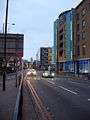 Goswell Road from Upper Street
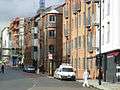 Goswell Road, Schenker office
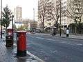 Goswell Road
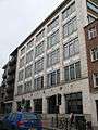 Goswell Road, Angel House
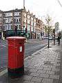 Goswell Road - Percival Street, EC1
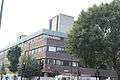 Goswell Road, City University
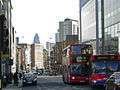 Goswell Road, towards the City
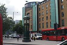
 Goswell Road clock tower
References
- ↑ "Goswell Road". Golden Lane Estate. Retrieved 2007-05-10.
- ↑ "Smithfield Fair". Barbican Living. Archived from the original on 10 February 2006. Retrieved 2007-05-11.
- ↑ Islington reference, Goswell Street. "Goswell Street".
- ↑ "A Guide to History Libraries and Collections in London". University of London Library. Archived from the original on 13 June 2007. Retrieved 2007-05-11.
- ↑ Croot, Patricia (1985). "Islington Introduction". A History of the County of Middlesex. British History Online. 8: 1–3. Retrieved 2007-05-11.
- ↑ Radford, Peter (2004-05-02). "The Time a Land Forgot". The Guardian.
- ↑ "The first four-minute mile". East London History. 2004. Archived from the original on 13 October 2004. Retrieved 11 May 2007.
- ↑ Radford, Peter (2004-05-06). "Runners of Old are Hard to Beat". Edinburgh Evening News.
- ↑ "Unveiling of Memorial to the Victims of the London Blitz". Dame Alice Owen's School. Retrieved 2007-05-11.
External links
| Wikimedia Commons has media related to Goswell Road. |
Coordinates: 43°38′56.85″N 79°32′18.21″W / 43.6491250°N 79.5383917°W