Goobertown, Arkansas
| Goobertown, Arkansas | |
|---|---|
| Unincorporated community | |
 Goobertown, Arkansas  Goobertown, Arkansas | |
| Coordinates: 35°57′05″N 90°34′32″W / 35.95139°N 90.57556°WCoordinates: 35°57′05″N 90°34′32″W / 35.95139°N 90.57556°W | |
| Country | United States |
| State | Arkansas |
| County | Craighead |
| Elevation | 302 ft (92 m) |
| Time zone | UTC-6 (Central (CST)) |
| • Summer (DST) | UTC-5 (CDT) |
| Area code(s) | 870 |
| GNIS feature ID | 77034[1] |
Goobertown is an unincorporated community in Craighead County, Arkansas, United States. Goobertown is located on U.S. Route 49, 10.4 miles (16.7 km) northeast of Jonesboro.[2]
Goobertown has been noted for its unusual place name.[3]
References
- ↑ "Goobertown". Geographic Names Information System. United States Geological Survey.
- ↑ Craighead County, Arkansas General Highway Map (PDF) (Map). Arkansas State Highway and Transportation Department. 2009. Retrieved September 19, 2012.
- ↑ Thompson, George E. (1 July 2009). You Live Where?: Interesting and Unusual Facts about where We Live. iUniverse. p. 7. ISBN 978-1-4401-3421-0.
Municipalities and communities of Craighead County, Arkansas, United States | ||
|---|---|---|
| Cities | 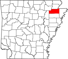 | |
| Towns | ||
| Unincorporated communities |
| |
| Ghost town | ||
This article is issued from
Wikipedia.
The text is licensed under Creative Commons - Attribution - Sharealike.
Additional terms may apply for the media files.