Gondwana Rainforests
| UNESCO World Heritage site | |
|---|---|
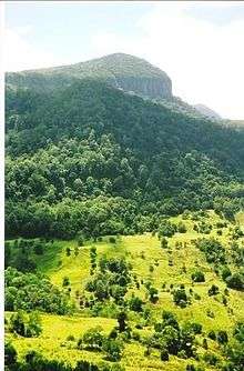
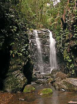 Box Log Falls, Lamington National Park in Queensland. | |
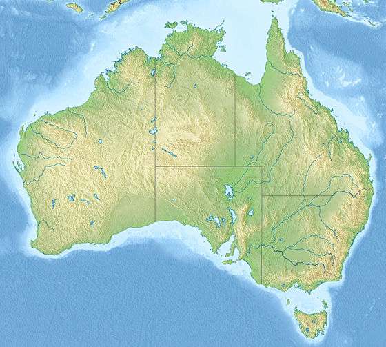
| Location | New South Wales and Queensland, Australia |
| Criteria | Natural: (viii), (ix), (x) |
| Reference | 368bis |
| Inscription | 1986 (10th Session) |
| Extensions | 1994 |
| Area | 370,000 ha (1,400 sq mi) |
| Coordinates | 28°15′S 150°3′E / 28.250°S 150.050°ECoordinates: 28°15′S 150°3′E / 28.250°S 150.050°E |
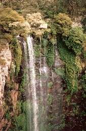
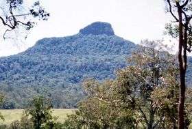
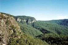
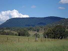
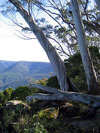
 Barrington Tops Main Range National Park From the Main Range in the north to the Barrington Tops in the south, various grouping of the Gondwana Rainforests on the Australian continent | |
| Official name | Gondwana Rainforests of Australia |
| Type | National heritage (landscape) |
| Designated | 17 December 1994 |
| Reference no. | 105135 |
| Class | Natural |
| Legal Status | Declared property |
| Official name | Gondwana Rainforests of Australia; Central Eastern Rainforest Reserves; Gondwana Rainforests of Australia (new name from 2007); North East Rainforests World Heritage Area |
| Type | State heritage (landscape) |
| Designated | 2 April 1999 |
| Reference no. | 1002 |
| Type | Wilderness |
| Category | Landscape - Natural |
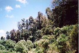
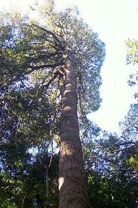
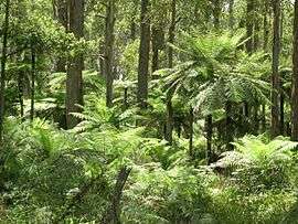
The Gondwana Rainforests of Australia, formerly known as the Central Eastern Rainforest Reserves, are the most extensive area of subtropical rainforest in the world.[1] Collectively, the rainforests are a World Heritage Site with fifty separate reserves totalling 366,500 hectares (906,000 acres) from Newcastle to Brisbane.[2]
The Gondwana Rainforests are so-named because the fossil record indicates that when Gondwana existed it was covered by rainforests containing the same kinds of species that are living today. Not all Gondwanan rainforests in Australia are located in the New South Wales – Queensland region; the largest Gondwanan rainforest in Australia is located in Tasmania's Tarkine wilderness. The number of visitors to the Gondwana rainforest reserves in New South Wales and Queensland is about 2 million per year.[1]
The World Heritage status of the region was created and negotiated initially in 1986, with the area extended in 1994, and carries the following inscription:[1]
The Gondwana Rainforests of Australia is a serial property comprising the major remaining areas of rainforest in southeast Queensland and northeast New South Wales. It represents outstanding examples of major stages of the Earth’s evolutionary history, ongoing geological and biological processes, and exceptional biological diversity. A wide range of plant and animal lineages and communities with ancient origins in Gondwana, many of which are restricted largely or entirely to the Gondwana Rainforests, survive in this collection of reserves. The Gondwana Rainforests also provides the principal habitat for many threatened species of plants and animals.
— Brief synthesis of the Gondwana Rainforests of Australia as inscribed on the UNESCO World Heritage List.
The site was gazetted on the Australian National Heritage List on 21 May 2007[3] under the Environment and Heritage Legislation Amendment Act (No. 1), 2003 (Cth);[4] and the New South Wales portion was added to the New South Wales State Heritage Register on 2 April 1999.[5]
Conservation value
The forests were inscribed to the World Heritage list in 1986, covering only the New South Wales sites of approximately 310,800 hectares (768,000 acres) and extended in 1994 to cover the Queensland sites of approximately 59,200 hectares (146,000 acres) which is a total of approximately 370,000 hectares (910,000 acres). The rainforest reserves have an extremely high conservation value, with more than 200 rare or threatened plant and animal species.[2]
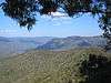
Eight separate areas have been identified as having outstanding heritage significance to Australia and are included on the Australian National Heritage List.[3] The altitude of the reserves ranges from sea level to almost 1,600 m (5,200 ft).[6]
On 22 December 2000, the High Conservation Value Old Growth forest covering 24 national parks and 19 nature reserves spread across 12 local government areas in the upper north east region of New South Wales were listed on the New South Wales State Heritage Register.[7]
National parks
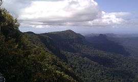
The Queensland areas include the Main Range, at its most northern point; and extending south, the Lamington, Mount Chinghee, Springbrook and Mount Barney national parks.
The New South Wales areas include the Barrington Tops, at its most southern point; and extending north, the Dorrigo, Mount Warning, New England, Mebbin, Nightcap, Border Ranges, Oxley Wild Rivers, Washpool, Willi Willi and Werrikimbe national parks.[8]
The most heavily visited parts are Dorrigo National Park and the Natural Bridge section of Springbrook National Park.[6]
Australian National Heritage List sections
The Gondwana Rainforests of Australia are divided into sections for listing on the Australian National Heritage List, from north to south, as below:

See also
- Environment of Australia
- Forests of Australia
- List of World Heritage Sites in Australia
- Mount Banda Banda
- Rainforest Way, a tourist drive featuring the Gondwana rainforests of south-eastern Queensland and north-eastern New South Wales
References
- 1 2 3 "Gondwana Rainforests of Australia". Department of the Environment. Australian Government. Archived from the original on 26 July 2008. Retrieved 31 August 2008.
- 1 2 Reid, Greg (2004). Australia's National and Marine Parks: Queensland. South Yarra, Victoria: Macmillan Education Australia. p. 11. ISBN 0-7329-9053-X.
- 1 2 "Gondwana Rainforests of Australia, Lismore, NSW, Australia". Australian Heritage Database: Department of the Environment. Australian Government. 2014. Retrieved 7 September 2014.
- ↑ "Determination regarding including World Heritage places in the National Heritage List" (PDF). Special government gazette (PDF). Department of the Environment and Water Resources, Commonwealth of Australia. 21 May 2007. Archived (PDF) from the original on 3 September 2014. Retrieved 30 August 2014.
- ↑ "Gondwana Rainforests of Australia, New South Wales State Heritage Register (NSW SHR) Number H01002". New South Wales State Heritage Register. Office of Environment and Heritage. Retrieved 2 June 2018.
- 1 2 McGinley, Mark (9 December 2008). "Central Eastern Rainforest Reserves, Australia". Encyclopedia of Earth. United Nations Environment Programme: World Conservation Monitoring Centre. Archived from the original on 16 October 2009. Retrieved 1 July 2009.
- ↑ "High Conservation Value Old Growth forest, New South Wales State Heritage Register (NSW SHR) Number H01487". New South Wales State Heritage Register. Office of Environment and Heritage. Retrieved 18 May 2018.
- ↑ "Gondwana Rainforests of Australia". World Heritage List. UNESCO. Archived from the original on 27 May 2008. Retrieved 9 June 2008.
- 1 2 "Main Range National Park and Spicers Gap Road Regional Park Management Statement 2013". Department of National Parks, Recreation, Sport and Racing. Government of Queensland. 11 November 2013. Archived from the original on 8 September 2014. Retrieved 7 September 2014.
- 1 2 Hunter, R. John (December 2004) [June 2003]. "9.2 Main Range Group". World Heritage and Associative Natural Values of the Central Eastern Rainforest Reserves of Australia (PDF). Government of New South Wales. p. 66. Archived (PDF) from the original on 24 September 2015. Retrieved 22 September 2014.
- ↑ "Mallanganee National Park". Office of Environment and Heritage. Government of New South Wales. Archived from the original on 7 September 2014. Retrieved 7 September 2014.
- ↑ "Mount Clunie National Park". Office of Environment and Heritage. Government of New South Wales. Archived from the original on 11 September 2014. Retrieved 10 September 2014.
- ↑ "Mount Nothofagus National Park". Office of Environment and Heritage. Government of New South Wales. Archived from the original on 11 September 2014. Retrieved 10 September 2014.
- ↑ "Tooloom National Park: Park management". Office of Environment and Heritage. Government of New South Wales. Archived from the original on 10 September 2014. Retrieved 10 September 2014.
- ↑ "Toonumbar National Park". Office of Environment and Heritage. Government of New South Wales. Archived from the original on 11 September 2014. Retrieved 10 September 2014.
- ↑ "Border Ranges National Park: Park management". NSW National Parks & Wildlife Service. Government of New South Wales. Archived from the original on 11 September 2014.
- ↑ "Limpinwood Nature Reserve: Park management". Office of Environment and Heritage. Government of New South Wales. Archived from the original on 5 December 2014. Retrieved 28 September 2014.
- ↑ "Numinbah Nature Reserve: Park management". Office of Environment and Heritage. Government of New South Wales. Archived from the original on 13 September 2014. Retrieved 28 September 2014.
- ↑ "Springbrook National Park: Nature, culture and history". Department of Environment, Resources, and Mining. Government of Queensland. 29 April 2009. Archived from the original on 24 March 2010. Retrieved 12 July 2009.
- ↑ "Wollumbin National Park". NSW National Parks & Wildlife Service. Government of New South Wales. 24 September 2013. Archived from the original on 2 May 2014. Retrieved 1 May 2014.
- ↑ "Iluka Nature Reserve: Park management". Office of Environment and Heritage. Government of New South Wales. Archived from the original on 11 October 2014. Retrieved 23 September 2014.
- ↑ "Mount Hyland Nature Reserve: Park management". Office of Environment and Heritage. Government of New South Wales. Archived from the original on 5 December 2014. Retrieved 28 September 2014.
- ↑ "New England National Park: Park management". Office of Environment and Heritage. Government of New South Wales. Archived from the original on 11 September 2014. Retrieved 10 September 2014.
- ↑ "Oxley Wild Rivers National Park: Park Management". Office of Environment and Heritage. Government of New South Wales. Archived from the original on 11 September 2014. Retrieved 10 September 2014.
- ↑ "The Castles Flora Reserve (NSW)". Gazetteer of Australia online. Geoscience Australia, Australian Government.
- ↑ "Werrikimbe National Park". Office of Environment and Heritage. Government of New South Wales. Archived from the original on 12 September 2014. Retrieved 10 September 2014.
- ↑ "Willi Willi National Park". Office of Environment and Heritage. Government of New South Wales. Archived from the original on 7 December 2014. Retrieved 10 September 2014.
- ↑ "Barrington Tops National Park". Office of Environment and Heritage. Government of New South Wales. Archived from the original on 11 September 2014. Retrieved 11 September 2014.
- ↑ "Mount Royal National Park". Office of Environment and Heritage. Government of New South Wales. Archived from the original on 11 September 2014. Retrieved 10 September 2014.
Attribution
![]()
External links
- World heritage listing for Gondwana Rainforests of Australia
- Introduction to Gondwana Rainforests of Australia
- Hunter, R. John (December 2004) [June 2003]. "World Heritage and Associative Natural Values of the Central Eastern Rainforest Reserves of Australia" (PDF). NSW National Parks & Wildlife Service (PDF). Government of New South Wales.