Gobernador Piñero, San Juan, Puerto Rico
| Barrio of Gobernador Piñero | |
|---|---|
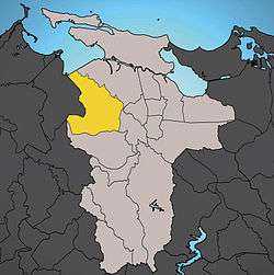 Location of Gobernador Piñero shown in yellow. | |
| Country |
|
| Territory |
|
| Municipality |
|
| Area | |
| • Total | 4.71 sq mi (12.20 km2) |
| • Land | 4.44 sq mi (11.50 km2) |
| • Water | 0.27 sq mi (0.70 km2) |
| Population (2000) | |
| • Total | 47,779 |
| • Density | 10,770.4/sq mi (4,158.47/km2) |
| 2000 census | |
With a population in 2000 of 47,779 living in a land area of 4.44 square miles (11.5 km2), Gobernador Piñero is San Juan’s second most populated barrio after Santurce, and the fourth largest in land area. It has a population density of 10,770.4 residents per square mile (4,158.47/km²). Gobernador Piñero is bounded to the North by the San Juan Harbor and Hato Rey Norte Barrio, with the barrios of Hato Rey Sur and El Cinco to the East, by Monacillo Urbano to the South, and by the municipality of Guaynabo to the West.
Gobernador Piñero includes the areas of Puerto Nuevo (including Puerto Nuevo Norte), Villa Borinquen, Bosque Urbano de San Patricio, Caparra Terrace and Centro Médico.
The Martínez Nadal Tren Urbano station is located in the neighbourhood of Gobernador Piñero bordering with the municipality of Guaynabo.
References
Coordinates: 18°24′28″N 66°05′22″W / 18.40778°N 66.08944°W
| ||
| Barrios | ||