El Cinco, San Juan, Puerto Rico
| Barrio of El Cinco | |
|---|---|
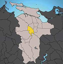 Location of El Cinco shown in yellow. | |
| Country |
|
| Territory |
|
| Municipality |
|
| Area | |
| • Total | 1.38 sq mi (3.57 km2) |
| • Land | 1.37 sq mi (3.55 km2) |
| • Water | 0.01 sq mi (0.03 km2) |
| Population (2000) | |
| • Total | 7,149 |
| • Density | 5,207.9/sq mi (2,010.78/km2) |
| 2000 census | |
El Cinco is a barrio of the municipality of San Juan, Puerto Rico and a former barrio of the dissolved municipality of Rio Piedras. In the year 2000 it had a population of 7,149 and a land area of 1.37 square miles (3.55 km²) resulting in a population density of 5,207.9/sq mi (2,010.78/km2). El Cinco is surrounded by seven barrios: Gobernador Piñero, Monacillo Urbano, Monacillo, Cupey, Sabana Llana Sur, Río Piedras (pueblo), and Hato Rey Sur.
The elevated section of the Tren Urbano with the Cupey station is located on the intersection of highways PR-1 and PR-176 in El Cinco.
Coordinates: 18°23′30″N 66°03′45″W / 18.39167°N 66.06250°W
| ||
| Barrios | ||
This article is issued from
Wikipedia.
The text is licensed under Creative Commons - Attribution - Sharealike.
Additional terms may apply for the media files.