Glomfjord
| Glomfjord | |
|---|---|
| Village | |
 View of the village | |
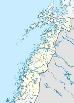
 Glomfjord Location in Nordland  Glomfjord Glomfjord (Norway) | |
| Coordinates: 66°48′59″N 13°56′38″E / 66.81639°N 13.94389°ECoordinates: 66°48′59″N 13°56′38″E / 66.81639°N 13.94389°E | |
| Country | Norway |
| Region | Northern Norway |
| County | Nordland |
| District | Salten |
| Municipality | Meløy |
| Area[1] | |
| • Total | 1.13 km2 (0.44 sq mi) |
| Elevation[2] | 111 m (364 ft) |
| Population (2013)[1] | |
| • Total | 1,120 |
| • Density | 991/km2 (2,570/sq mi) |
| Time zone | UTC+01:00 (CET) |
| • Summer (DST) | UTC+02:00 (CEST) |
| Post Code | 8160 Glomfjord |
Glomfjord is a village in the municipality of Meløy in Nordland county, Norway. The industrial community is located along Norwegian County Road 17 at the head of the Glomfjorden, just north of the Arctic Circle. The 1.13-square-kilometre (280-acre) village has a population (2013) of 1,120. The population density is 991 inhabitants per square kilometre (2,570/sq mi).[1]
Heavy industry
The village is based around the Glomfjord hydroelectric power plant, which was the target of the 1942 commando raid entitled Operation Musketoon. Norsk Hydro, Norway's greatest industry, established fertilizer production here in 1912. The facilities were bought by the state in 1918, but leased to Hydro in 1947 (now the fertilizer division is known as Yara International). Today a conglomerate of industries are found in Glomfjord Industry Park. The Forså and Sundsfjord hydroelectric power stations were also built to supply power to industry in Glomfjord in 1963.[3][4]
Climate
Although located north of the Arctic Circle and not far from Norway's second largest glacier Svartisen, the climate is well suited for living due to the Gulf Stream, albeit rather wet. Average annual rainfall in Glomfjord is about 2,069 millimetres (81.5 in), with mean annual temperature 5 °C (41 °F).[5] The temperature is seldom below −10 °C (14 °F) during winter time. During summer time the sun does not set. The midnight sun also makes the plants grow faster.
| Climate data for GLOMFJORD (80700), Nordland (1961-1990) | |||||||||||||
|---|---|---|---|---|---|---|---|---|---|---|---|---|---|
| Month | Jan | Feb | Mar | Apr | May | Jun | Jul | Aug | Sep | Oct | Nov | Dec | Year |
| Average high °C (°F) | 1.3 (34.3) |
1.5 (34.7) |
3.1 (37.6) |
5.8 (42.4) |
10.9 (51.6) |
14.3 (57.7) |
16.1 (61) |
15.6 (60.1) |
11.9 (53.4) |
8.2 (46.8) |
4.1 (39.4) |
2.1 (35.8) |
7.9 (46.2) |
| Daily mean °C (°F) | −1.3 (29.7) |
−1.1 (30) |
0.3 (32.5) |
2.9 (37.2) |
7.5 (45.5) |
10.7 (51.3) |
12.5 (54.5) |
12.2 (54) |
8.9 (48) |
5.8 (42.4) |
1.7 (35.1) |
−0.4 (31.3) |
5.0 (41) |
| Average low °C (°F) | −3.9 (25) |
−3.6 (25.5) |
−2.4 (27.7) |
0.2 (32.4) |
4.5 (40.1) |
7.7 (45.9) |
9.9 (49.8) |
9.6 (49.3) |
6.4 (43.5) |
3.5 (38.3) |
−0.6 (30.9) |
−2.8 (27) |
2.4 (36.3) |
| Average precipitation mm (inches) | 194 (7.64) |
163 (6.42) |
148 (5.83) |
117 (4.61) |
90 (3.54) |
99 (3.9) |
143 (5.63) |
153 (6.02) |
237 (9.33) |
283 (11.14) |
212 (8.35) |
230 (9.06) |
2,069 (81.47) |
| Average precipitation days (≥ 1 mm) | 15.8 | 15.0 | 13.7 | 13.4 | 11.9 | 14.7 | 16.6 | 16.0 | 18.7 | 18.7 | 16.4 | 17.3 | 188.2 |
| Source: eKlima[6] | |||||||||||||
Tourism
Glomfjord has a hotel, a bistro, a WaterLand (with two slides and two pools), and some beautiful mountains for skiing and snowboarding in the winter. There is touring with fishing, climbing, and other relaxing activities in the mountains during summer. Svartisen and the lake Storglomvatnet are tourist destinations also.
References
- 1 2 3 Statistisk sentralbyrå (1 January 2013). "Urban settlements. Population and area, by municipality".
- ↑ "Glomfjord" (in Norwegian). yr.no. Retrieved 2012-02-09.
- ↑ Store norske leksikon: Forså kraftverk.
- ↑ Store norske leksikon: Sundsfjord kraftverk.
- ↑ met.no climate statistics Archived 2007-05-18 at the Wayback Machine.
- ↑ "eKlima". Norwegian Meteorological Institute. Retrieved 23 December 2017.