Gledhow, Western Australia
| Gledhow Albany, Western Australia | |||||||||||||||
|---|---|---|---|---|---|---|---|---|---|---|---|---|---|---|---|
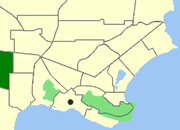 Map of Gledhow within Albany. | |||||||||||||||
| Population | 939 (2011 census)[1] | ||||||||||||||
| • Density | 142.3/km2 (368.5/sq mi) | ||||||||||||||
| Postcode(s) | 6330 | ||||||||||||||
| Area | 6.6 km2 (2.5 sq mi) | ||||||||||||||
| Location | 6.5 km (4 mi) from Albany | ||||||||||||||
| LGA(s) | City of Albany | ||||||||||||||
| State electorate(s) | Albany | ||||||||||||||
| Federal Division(s) | O'Connor | ||||||||||||||
| |||||||||||||||
Coordinates: 35°00′06″S 117°48′54″E / 35.0017°S 117.815°E
Gledhow is a western suburb of Albany in southern Western Australia. Its local government area is the City of Albany. The suburb has a median age of 38.
References
- ↑ Australian Bureau of Statistics (31 October 2012). "Gledhow (State Suburb)". 2011 Census QuickStats. Retrieved 2015-01-04.

This article is issued from
Wikipedia.
The text is licensed under Creative Commons - Attribution - Sharealike.
Additional terms may apply for the media files.