Gin, Mississippi
| Gin, Mississippi | |
|---|---|
| Ghost town | |
 Gin | |
| Coordinates: 31°54′57″N 88°37′50″W / 31.91583°N 88.63056°WCoordinates: 31°54′57″N 88°37′50″W / 31.91583°N 88.63056°W | |
| Country | United States |
| State | Mississippi |
| County | Clarke |
| Elevation | 322 ft (98 m) |
| Time zone | UTC-6 (Central (CST)) |
| • Summer (DST) | UTC-5 (CDT) |
| GNIS feature ID | 687514[1] |
Gin is a ghost town in Clarke County, Mississippi, United States. It once had a post office.[2]
References
Municipalities and communities of Clarke County, Mississippi, United States | ||
|---|---|---|
| City | 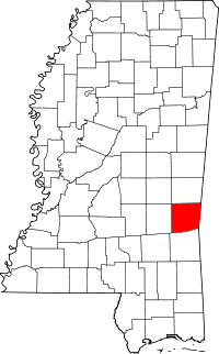 | |
| Towns | ||
| Unincorporated communities | ||
| Ghost town | ||
This article is issued from
Wikipedia.
The text is licensed under Creative Commons - Attribution - Sharealike.
Additional terms may apply for the media files.