Gimpo
| Gimpo 김포시 | ||
|---|---|---|
| Municipal City | ||
| Korean transcription(s) | ||
| • Hangul | 김포시 | |
| • Hanja | 金浦市 | |
| • Revised Romanization | Gimpo-si | |
| • McCune-Reischauer | Kimp'o-si | |
| ||
 Location in South Korea | ||
| Country |
| |
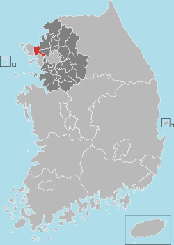
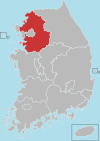
| Region | Sudogwon | |
| Administrative divisions | 3 eup, 5 myeon, 7 dong | |
| Area | ||
| • Total | 276.6 km2 (106.8 sq mi) | |
| Population (2013 Jun) | ||
| • Total | 300,000 | |
| • Density | 1,084.59/km2 (2,809.1/sq mi) | |
| • Dialect | Seoul | |
Gimpo (Korean pronunciation: [kim.pʰo]) is a city in Gyeonggi Province, South Korea. It borders Incheon, with which it shares the South Korean side of the Han River estuary, as well as Seoul and the lesser cities of Paju and Goyang. North Korea is across the Han River. The current mayor is Jeong Hayoung (정하영). The city's population of more than 300,000 is made up of more than 71,000 households.
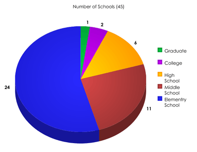
Gimpo Airport (formerly Kimpo International Airport) used to be located inside the city, but is now part of Seoul. Tertiary educational institutions located in the city include Kimpo College and Joong-ang Seungga University. There are 27 elementary schools, 12 middle schools, and 8 high schools, including Gimpo Foreign Language High School. Three elementary schools, two middle, and two high schools are located in the area of Tongjin.
Modern history
In 1914, Yangcheon county and Gimpo county were merged. Yangcheon county was separated into 2 towns (Yangdong and Yangseo). In 1958, Yeouido international airport was relocated to Gimpo. In 1963, Yangdong and Yangseo towns were incorporated into Yeongdeungpo-gu; it includes Gimpo airport. In 1973, Gyeyang and Ojeong towns of Bucheon were transferred to Gimpo. In 1989, parts of Gyeyang town were ceded to Incheon, giving Incheon a border with southwestern Seoul. The airport at Kimpo (Gimpo) was known as "K-14" Air Force Base during the Korean War. Sabre jets were based and operated from K-14 to "Mig Alley" located in the north western area of North Korea, and where air combat would take place with enemy Mig aircraft. A large number of U.S. Air Force bases were located thru out South Korea during the Korean War, and each of them had a "K" number, again with Kimpo being K-14, and with the "K" meaning Korea.
Statistics
Tourist spot
- Munsu Fortress
- Jangneung
- Deokpojin
- Aegi Peak
- Daemyeong Port
- DMZ Peace Trail
Sister cities


See also
External links
Suwon (capital) | ||||||||||||||||||||
 | Specific cities |
| ||||||||||||||||||
| Cities | ||||||||||||||||||||
| Counties | ||||||||||||||||||||
Coordinates: 37°42′0″N 126°36′0″E / 37.70000°N 126.60000°E