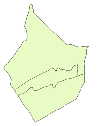
Gharanij
| Gharanij غرانيج | |
|---|---|
| Town | |
 Gharanij Location in Syria | |
| Coordinates: 34°47′2″N 40°43′42″E / 34.78389°N 40.72833°ECoordinates: 34°47′2″N 40°43′42″E / 34.78389°N 40.72833°E | |
| Country |
|
| Governorate | Deir ez-Zor |
| District | Abu Kamal District |
| Subdistrict | Hajin Subdistrict |
| Population (2004) | |
| • Total | 23,009 |
| Time zone | UTC+2 (EET) |
| • Summer (DST) | UTC+3 (EEST) |
| City Qrya Pcode | C5173 |
Gharanij (Arabic: غرانيج) is a Syrian town located in Abu Kamal District, Deir ez-Zor. According to the Syria Central Bureau of Statistics (CBS), Gharanij had a population of 23,009 in the 2004 census.[1] On 9 December 2017, Gharanij was captured by Syrian Democratic Forces.[2] On 21 December 2017, the Islamic State still controlled the town and was once again liberated by the Syrian Democratic Forces in late December.[3]
References
- ↑ "General Census of Population 2004". Retrieved 2017-12-01.
- ↑ "SDF Seizes Gharanij Town Eastern Deir Ezzor". Retrieved 2017-12-09.
- ↑ Airstrikes target the eastern countryside of Deir Ezzor and the regime forces target the countryside of Homs and Quneitra
This article is issued from
Wikipedia.
The text is licensed under Creative Commons - Attribution - Sharealike.
Additional terms may apply for the media files.
