Ghanool
| Ghanool | |
|---|---|
| Union Council and Village | |
| Country | Pakistan |
| Region | Khyber-Pakhtunkhwa |
| District | Mansehra District |
| Population | |
| • Total | 40,000 |
| • Density | 10/km2 (30/sq mi) |
| Time zone | UTC+5 (PST) |
| Area code(s) | 0997 |
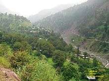
Ghanool is a village and union council (an administrative subdivision) of Mansehra District in the Khyber-Pakhtunkhwa province of Pakistan.[1] It is located in Balakot tehsil and lies in an area that was affected by the 2005 Kashmir earthquake.[2] UC Ghanool has four village councils i.e Ghanool, Sangar-1, Sangar-2 and Bhangian. Sangar is most populous area of Ghanool with Madakhel in majority.
Paya, which is also known as Sari and Paya, is a meadow at the height of more than 9000 feet with views of Makkra Parbat. The area is full of thick pine forests and wild alpine flowers.
Makra Mountain which is 12743 feet above the sea level part of Ghanool.
Ghanool
References
3- Photo By Khaliq zaman

Ghanool
This article is issued from
Wikipedia.
The text is licensed under Creative Commons - Attribution - Sharealike.
Additional terms may apply for the media files.