German Township, Vanderburgh County, Indiana
| German Township Vanderburgh County | |
|---|---|
| Township | |
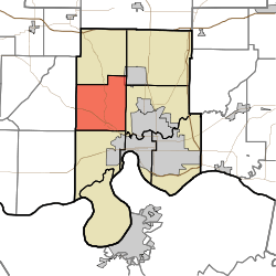 Location in Vanderburgh County | |
| Coordinates: 38°02′36″N 87°38′38″W / 38.04333°N 87.64389°WCoordinates: 38°02′36″N 87°38′38″W / 38.04333°N 87.64389°W | |
| Country | United States |
| State | Indiana |
| County | Vanderburgh |
| Government | |
| • Type | Indiana township |
| Area | |
| • Total | 28.84 sq mi (74.7 km2) |
| • Land | 28.56 sq mi (74.0 km2) |
| • Water | 0.28 sq mi (0.7 km2) 0.97% |
| Elevation | 479 ft (146 m) |
| Population (2010) | |
| • Total | 7,441 |
| • Density | 260.6/sq mi (100.6/km2) |
| ZIP codes | 47712, 47720 |
| GNIS feature ID | 453328 |
German Township is one of eight townships in Vanderburgh County, Indiana, USA. As of the 2010 census, its population was 7,441 and it contained 2,909 housing units.[1]
German Township was organized in 1845.[2]
Geography
According to the 2010 census, the township has a total area of 28.84 square miles (74.7 km2), of which 28.56 square miles (74.0 km2) (or 99.03%) is land and 0.28 square miles (0.73 km2) (or 0.97%) is water.[1]
Cities and towns
- Darmstadt (far west edge)
Unincorporated towns
Adjacent townships
- Vanderburgh County
- Armstrong Township (North)
- Scott Township (Northeast)
- Center Township (East)
- Perry Township (South)
- Posey County
- Robinson Township (West)
- Marrs Township (Single Point)
Cemeteries
The township contains these cemeteries: Higinbottom, Huber, Richter, Saint Peters, St. Joseph, and St. Paul's.
School districts
Political districts
- Indiana's 8th congressional district
- State House District 75
- State Senate District 50
References
- "German Township, Vanderburgh County, Indiana". Geographic Names Information System. United States Geological Survey. Retrieved 2010-02-20.
- United States Census Bureau 2007 TIGER/Line Shapefiles
- IndianaMap
- 1 2 "Population, Housing Units, Area, and Density: 2010 - County -- County Subdivision and Place -- 2010 Census Summary File 1". United States Census. Retrieved 2013-05-10.
- ↑ History of Vanderburgh County, Indiana: From the Earliest Times to the Present. Brant & Fuller. 1889. p. 63.
External links
Places adjacent to German Township, Vanderburgh County, Indiana | |
|---|---|
Municipalities and communities of Vanderburgh County, Indiana, United States | ||
|---|---|---|
| City | ||
| Town | ||
| Townships | ||
| CDPs | ||
| Unincorporated communities | ||
| Footnotes | ‡This populated place also has portions in an adjacent county or counties | |
This article is issued from
Wikipedia.
The text is licensed under Creative Commons - Attribution - Sharealike.
Additional terms may apply for the media files.