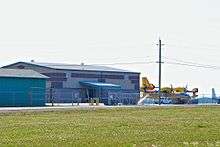
Geraldton (Greenstone Regional) Airport
| Geraldton (Greenstone Regional) Airport | |||||||||||
|---|---|---|---|---|---|---|---|---|---|---|---|
 | |||||||||||
| Summary | |||||||||||
| Airport type | Public | ||||||||||
| Operator | Town of Greenstone | ||||||||||
| Location | Geraldton, Ontario | ||||||||||
| Time zone | EST (UTC−05:00) | ||||||||||
| • Summer (DST) | EDT (UTC−04:00) | ||||||||||
| Elevation AMSL | 1,143 ft / 348 m | ||||||||||
| Coordinates | 49°46′43″N 086°56′19″W / 49.77861°N 86.93861°WCoordinates: 49°46′43″N 086°56′19″W / 49.77861°N 86.93861°W | ||||||||||
| Map | |||||||||||
 CYGQ Location in Ontario | |||||||||||
| Runways | |||||||||||
| |||||||||||
| Statistics (2010) | |||||||||||
| |||||||||||
Geraldton (Greenstone Regional) Airport, (IATA: YGQ, ICAO: CYGQ), is located 3 nautical miles (5.6 km; 3.5 mi) north of Geraldton, Ontario, Canada.
See also
References
- ↑ Canada Flight Supplement. Effective 0901Z 19 July 2018 to 0901Z 13 September 2018.
- ↑ Synoptic/Metstat Station Information Archived December 1, 2011, at the Wayback Machine.
- ↑ Total aircraft movements by class of operation
External links
- Past three hours METARs, SPECI and current TAFs for Geraldton (Greenstone Regional) Airport from Nav Canada as available.
| By name | |
|---|---|
| By location indicator | |
| By province/territory | |
| By area | |
| National Airports System | |
| Related | |
| |
This article is issued from
Wikipedia.
The text is licensed under Creative Commons - Attribution - Sharealike.
Additional terms may apply for the media files.