Georgia State Route 94
| ||||
|---|---|---|---|---|
 | ||||
| Route information | ||||
| Maintained by GDOT | ||||
| Length | 67.7 mi[1][2] (109.0 km) | |||
| Western section | ||||
| Length | 54.8 mi[1] (88.2 km) | |||
| West end |
| |||
| Major junctions |
| |||
| East end |
| |||
| Eastern section | ||||
| Length | 12.9 mi[2] (20.8 km) | |||
| West end |
| |||
| East end |
| |||
| Location | ||||
| Counties | Lowndes, Echols, Clinch, Charlton | |||
| Highway system | ||||
| ||||

State Route 94 (SR 94) is a 67.7-mile-long (109.0 km) state highway in the southeastern part of the U.S. state of Georgia. It exists in two distinct sections, split by the Florida state line, that runs west–east within portions Lowndes, Echols, Clinch, and Charlton counties.
Route description
Western segment
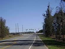
SR 94 begins at an intersection with US 41/SR 7/SR 31 (Inner Perimeter Road, which serves as a bypass of downtown Valdosta). The route continues to the southeast and enters Echols County. Just before entering Statenville, it intersects SR 135 and crosses over the Alapaha River. In Statenville, it meets US 129/SR 11. The highway passes through rural areas of the county until it enters Clinch County. Immediately, it enters Fargo, where it begins a concurrency with US 441/SR 89. The three routes cross over the Upper Suwannee River. Shortly southeast of Fargo, US 441/SR 89 splits off to the southwest. Immediately afterward is the southern terminus of SR 177. This intersection is unique, in that drivers on SR 177 that want to head south on US 441/SR 89 have to turn east on SR 94 and immediately turn right onto US 441/SR 89. SR 94 continues to the southeast, cuts across the southwestern corner of the Okefenokee National Wildlife Refuge, and reaches the eastern terminus of its western segment, the Florida state line, where the roadway continues as State Road 2.[1]
Eastern segment
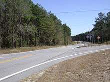
The route resumes at the spot where Florida State Road 2 meets the Georgia state line, west of Moniac, on the southeastern edge of the Okefenokee National Wildlife Refuge, at a crossing over the St. Marys River, within Charlton County. In Moniac, it intersects the northern terminus of SR 185. The highway travels through rural areas of the county, until it enters St. George. Here, it intersects SR 23/SR 121 (Florida Avenue), just before it reaches its eastern terminus, a second instance with the Florida State line. Here, the roadway continues as County Road 2 (CR 2), over the St. Marys River.[2]
National Highway System
SR 94 is not part of the National Highway System, a system of roadways important to the nation's economy, defense, and mobility.[3]
Major intersections
Mileage resets at the gap.
| County | Location | mi[1][2] | km | Destinations | Notes | ||
|---|---|---|---|---|---|---|---|
| Lowndes | | 2.4 | 3.9 | Western terminus of western segment | |||
| Echols | | 15.0 | 24.1 | ||||
| Statenville | 17.0 | 27.4 | |||||
| Clinch | Fargo | 45.7 | 73.5 | Western end of US 441/SR 89 concurrency | |||
| | 46.5 | 74.8 | Eastern end of US 441/SR 89 concurrency | ||||
| | 54.8 | 88.2 | Florida state line; eastern terminus of western segment | ||||
| Gap in route | |||||||
| Charlton | | 0.0 | 0.0 | Florida state line (St. Marys River bridge); western terminus of eastern segment | |||
| Moniac | 0.3 | 0.48 | Northern terminus of SR 185 | ||||
| Saint George | 11.7 | 18.8 | |||||
| | 12.9 | 20.8 | Florida state line (St. Marys River bridge); eastern terminus of eastern segment | ||||
1.000 mi = 1.609 km; 1.000 km = 0.621 mi
| |||||||
See also
.svg.png)

References
- 1 2 3 4 Google (July 18, 2013). "Route of SR 94's western section" (Map). Google Maps. Google. Retrieved July 18, 2013.
- 1 2 3 4 Google (July 18, 2013). "Route of SR 94's eastern section" (Map). Google Maps. Google. Retrieved July 18, 2013.
- ↑ "National Highway System: Georgia" (PDF). United States Department of Transportation. October 1, 2012. Retrieved July 19, 2013.
External links
| Wikimedia Commons has media related to Georgia State Route 94. |