Georgia State Route 114
| ||||
|---|---|---|---|---|
 | ||||
| Route information | ||||
| Maintained by GDOT | ||||
| Length | 12.7 mi[1] (20.4 km) | |||
| Major junctions | ||||
| South end |
| |||
|
| ||||
| North end |
| |||
| Location | ||||
| Counties | Chattooga | |||
| Highway system | ||||
| ||||

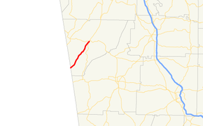
State Route 114 (SR 114) is a 12.7-mile-long (20.4 km) state highway located entirely within Chattooga County in the northwestern part of the U.S. state of Georgia.
Route description
The route begins at the Alabama state line as a continuation of Alabama State Route 68. The highway runs parallel to the Chattooga River, going through the towns of Chattoogaville and Lyerly before reaching Summerville. In Summerville, SR 100 has a short concurrency with SR 114 until they both reach their northern terminus at an intersection with US 27/SR 1.
SR 114 is not part of the National Highway System, a system of roadways important to the nation's economy, defense, and mobility.[2]
Major intersections
The entire route is in Chattooga County.
| Location | mi[1] | km | Destinations | Notes | |
|---|---|---|---|---|---|
| Chattoogaville | 0.0 | 0.0 | Continuation into Alabama | ||
| Summerville | 12.2 | 19.6 | Southern end of SR 100 concurrency | ||
| 12.7 | 20.4 | Northern terminus; northern end of SR 100 concurrency | |||
1.000 mi = 1.609 km; 1.000 km = 0.621 mi
| |||||
See also
.svg.png)

References
- 1 2 Google (June 14, 2013). "Route of SR 114" (Map). Google Maps. Google. Retrieved June 14, 2013.
- ↑ "National Highway System: Georgia" (PDF). United States Department of Transportation. May 8, 2009. Retrieved June 14, 2013.
External links
Route map:
This article is issued from
Wikipedia.
The text is licensed under Creative Commons - Attribution - Sharealike.
Additional terms may apply for the media files.