Gebsattel
| Gebsattel | ||
|---|---|---|
| ||
 Gebsattel Location of Gebsattel within Ansbach district 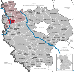 | ||
| Coordinates: 49°21′N 10°11′E / 49.350°N 10.183°ECoordinates: 49°21′N 10°11′E / 49.350°N 10.183°E | ||
| Country | Germany | |
| State | Bavaria | |
| Admin. region | Mittelfranken | |
| District | Ansbach | |
| Municipal assoc. | Rothenburg ob der Tauber | |
| Government | ||
| • Mayor | Willi Hassold (SPD) | |
| Area | ||
| • Total | 19.12 km2 (7.38 sq mi) | |
| Elevation | 378 m (1,240 ft) | |
| Population (2017-12-31)[1] | ||
| • Total | 1,747 | |
| • Density | 91/km2 (240/sq mi) | |
| Time zone | CET/CEST (UTC+1/+2) | |
| Postal codes | 91607 | |
| Dialling codes | 09861 | |
| Vehicle registration | AN | |
| Website | www.gebsattel.de | |

Gebsattel is a municipality in the district of Ansbach in Bavaria in Germany.
Main sights
 catholic church of Saint Laurentius
-26032012.JPG) one of the old ports
one of the old ports
Neighborhoods, districts
Gebsattel has 9 neighborhoods or districts[2]:* Bockenfeld
- Eckartshof
- Gebsattel
- Kirnberg
- Pleikartshof
- Rödersdorf
- Speierhof
- Wasenmühle
- Wildenhof
References
External links
| Wikimedia Commons has media related to Gebsattel. |
- Map of the municipality
- "Gebsattel: History of the coat-of-arms" (in German). Haus der Bayerischen Geschichte.
- Gebsattel: Official statistics compiled by the Bavarian State Office of Statistics (LfStat)
This article is issued from
Wikipedia.
The text is licensed under Creative Commons - Attribution - Sharealike.
Additional terms may apply for the media files.