Gatteo
| Gatteo | |
|---|---|
| Comune | |
| Comune di Gatteo | |
 Gatteo Location of Gatteo in Italy | |
| Coordinates: 44°6′N 12°23′E / 44.100°N 12.383°ECoordinates: 44°6′N 12°23′E / 44.100°N 12.383°E | |
| Country | Italy |
| Region | Emilia-Romagna |
| Province | Province of Forlì-Cesena (FC) |
| Frazioni | Fiumicino, Gatteo a Mare, Sant'Angelo |
| Area | |
| • Total | 14.1 km2 (5.4 sq mi) |
| Population (Dec. 2004) | |
| • Total | 7,252 |
| • Density | 510/km2 (1,300/sq mi) |
| Demonym(s) | Gatteesi |
| Time zone | UTC+1 (CET) |
| • Summer (DST) | UTC+2 (CEST) |
| Postal code | 47030, 47039, 47043 |
| Dialing code | 0541, 0547 |
| Patron saint | St. Lawrence |
| Saint day | August 10 |
| Website | Official website |
Gatteo (Romagnol: Gatì) is a comune (municipality) in the Province of Forlì-Cesena in the Italian region Emilia-Romagna, located about 90 kilometres (56 mi) southeast of Bologna and about 30 kilometres (19 mi) southeast of Forlì. As of 31 December 2004, it had a population of 7,252 and an area of 14.1 square kilometres (5.4 sq mi).[1]
Gatteo borders the following municipalities: Cesenatico, Gambettola, Longiano, Savignano sul Rubicone.
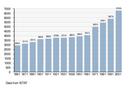
Demographic evolution
References
External links

This article is issued from
Wikipedia.
The text is licensed under Creative Commons - Attribution - Sharealike.
Additional terms may apply for the media files.