Garwood, New Jersey
| Garwood, New Jersey | |
|---|---|
| Borough | |
| Borough of Garwood | |
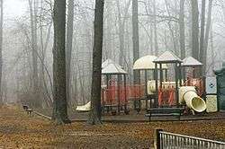 A local park in Garwood | |
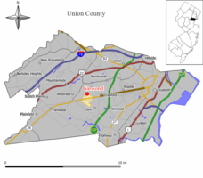 Map of Garwood in Union County. Inset: Location of Union County in the State of New Jersey. | |
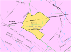 Census Bureau map of Garwood, New Jersey | |
| Coordinates: 40°39′04″N 74°19′23″W / 40.651249°N 74.323137°WCoordinates: 40°39′04″N 74°19′23″W / 40.651249°N 74.323137°W[1][2] | |
| Country |
|
| State |
|
| County | Union |
| Incorporated | March 19, 1903 |
| Government[3] | |
| • Type | Borough |
| • Body | Borough Council |
| • Mayor | Charles P. Lombardo (D, term ends December 31, 2018)[4][5] |
| • Administrator / Municipal clerk | Christina M. Ariemma[6] |
| Area[1] | |
| • Total | 0.664 sq mi (1.720 km2) |
| • Land | 0.664 sq mi (1.720 km2) |
| • Water | 0.000 sq mi (0.000 km2) 0.00% |
| Area rank |
533rd of 566 in state 20th of 21 in county[1] |
| Elevation[7] | 82 ft (25 m) |
| Population (2010 Census)[8][9][10][11] | |
| • Total | 4,226 |
| • Estimate (2016)[12] | 4,347 |
| • Rank |
404th of 566 in state 20th of 21 in county[13] |
| • Density | 6,362.7/sq mi (2,456.7/km2) |
| • Density rank |
76th of 566 in state 8th of 21 in county[13] |
| Time zone | UTC-5 (Eastern (EST)) |
| • Summer (DST) | UTC-4 (Eastern (EDT)) |
| ZIP code | 07027[14][15] |
| Area code(s) | 908[16] |
| FIPS code | 3403925800[1][17][18] |
| GNIS feature ID | 0885229[1][19] |
| Website |
www |
Garwood is a borough in Union County, New Jersey, United States. As of the 2010 United States Census, the borough's population was 4,226,[8][9][10] reflecting an increase of 73 (+1.8%) from the 4,153 counted in the 2000 Census, which had in turn declined by 74 (-1.8%) from the 4,227 counted in the 1990 Census.[20]
History
Garwood was incorporated as a borough on March 19, 1903, from portions of Cranford Township and Westfield Town.[21]
Geography
According to the United States Census Bureau, the borough had a total area of 0.664 square miles (1.720 km2), all of which was land.[1][2]
The borough is roughly bisected by the tracks of NJ Transit's Raritan Valley Line, originally built as part of the Jersey Central railroad. On the north side of the railroad, most of the streets are numbered, while on the south side of Garwood most of the streets are named after trees.
Garwood borders the Union County municipalities of Cranford and Westfield.[22]
Demographics
| Historical population | |||
|---|---|---|---|
| Census | Pop. | %± | |
| 1910 | 1,118 | — | |
| 1920 | 2,084 | 86.4% | |
| 1930 | 3,344 | 60.5% | |
| 1940 | 3,622 | 8.3% | |
| 1950 | 4,622 | 27.6% | |
| 1960 | 5,426 | 17.4% | |
| 1970 | 5,260 | −3.1% | |
| 1980 | 4,752 | −9.7% | |
| 1990 | 4,227 | −11.0% | |
| 2000 | 4,153 | −1.8% | |
| 2010 | 4,226 | 1.8% | |
| Est. 2016 | 4,347 | [12][23] | 2.9% |
| Population sources: 1910-1920[24] 1900-1910[25] 1910-1930[26] 1930-1990[27] 2000[28][29] 2010[8][9][10] | |||
Census 2010
As of the 2010 United States Census, there were 4,226 people, 1,778 households, and 1,118 families residing in the borough. The population density was 6,362.7 per square mile (2,456.7/km2). There were 1,870 housing units at an average density of 2,815.5 per square mile (1,087.1/km2). The racial makeup of the borough was 93.23% (3,940) White, 1.06% (45) Black or African American, 0.02% (1) Native American, 2.04% (86) Asian, 0.00% (0) Pacific Islander, 1.80% (76) from other races, and 1.85% (78) from two or more races. Hispanic or Latino of any race were 8.83% (373) of the population.[8]
There were 1,778 households out of which 23.9% had children under the age of 18 living with them, 47.5% were married couples living together, 10.7% had a female householder with no husband present, and 37.1% were non-families. 29.9% of all households were made up of individuals, and 10.6% had someone living alone who was 65 years of age or older. The average household size was 2.38 and the average family size was 3.00.[8]
In the borough, the population was spread out with 19.3% under the age of 18, 6.4% from 18 to 24, 30.4% from 25 to 44, 28.7% from 45 to 64, and 15.2% who were 65 years of age or older. The median age was 41.4 years. For every 100 females there were 93.9 males. For every 100 females ages 18 and older there were 92.3 males.[8]
The Census Bureau's 2006-2010 American Community Survey showed that (in 2010 inflation-adjusted dollars) median household income was $72,254 (with a margin of error of +/- $9,274) and the median family income was $86,959 (+/- $8,603). Males had a median income of $58,258 (+/- $3,197) versus $43,455 (+/- $3,625) for females. The per capita income for the borough was $35,753 (+/- $2,821). About 0.9% of families and 1.8% of the population were below the poverty line, including 0.0% of those under age 18 and 0.0% of those age 65 or over.[30]
Census 2000
As of the 2000 United States Census[17] there were 4,153 people, 1,731 households, and 1,125 families residing in the borough. The population density was 6,292.9 people per square mile (2,429.5/km2). There were 1,782 housing units at an average density of 2,700.2 per square mile (1,042.5/km2). The racial makeup of the borough was 95.91% White, 0.36% African American, 1.32% Asian, 1.54% from other races, and 0.87% from two or more races. Hispanic or Latino of any race were 4.98% of the population.[28][29]
There were 1,731 households out of which 26.2% had children under the age of 18 living with them, 49.0% were married couples living together, 12.1% had a female householder with no husband present, and 35.0% were non-families. 28.7% of all households were made up of individuals and 11.5% had someone living alone who was 65 years of age or older. The average household size was 2.40 and the average family size was 2.96.[28][29]
In the borough the population was spread out with 20.0% under the age of 18, 6.3% from 18 to 24, 35.6% from 25 to 44, 20.9% from 45 to 64, and 17.2% who were 65 years of age or older. The median age was 38 years. For every 100 females, there were 93.3 males. For every 100 females age 18 and over, there were 89.6 males.[28][29]
The median income for a household in the borough was $52,571, and the median income for a family was $64,053. Males had a median income of $50,951 versus $36,538 for females. The per capita income for the borough was $26,944. About 3.5% of families and 5.1% of the population were below the poverty line, including 6.3% of those under age 18 and 6.4% of those age 65 or over.[28][29]
Government
Local government
Garwood is governed under the Borough form of New Jersey municipal government. The governing body consists of a Mayor and a Borough Council comprising six council members, with all positions elected at-large on a partisan basis as part of the November general election. A Mayor is elected directly by the voters to a four-year term of office. The Borough Council consists of six members elected to serve three-year terms on a staggered basis, with two seats coming up for election each year in a three-year cycle.[3] The Borough form of government used by Garwood, the most common system used in the state, is a "weak mayor / strong council" government in which council members act as the legislative body with the mayor presiding at meetings and voting only in the event of a tie. The mayor can veto ordinances subject to an override by a two-thirds majority vote of the council. The mayor makes committee and liaison assignments for council members, and most appointments are made by the mayor with the advice and consent of the council.[31][32]
As of 2018, the Mayor of Garwood is Democrat Charles P. Lombardo, whose term of office ends December 31, 2018. Members of the Garwood Borough Council are Council President Jennifer Blumenstock (D, 2019), Stephanie Bianco (R, 2018; appointed to serve an unexpired term), Ileen Bocchino-Cuccaro (R, 2018), Marc Lazarow, (D, 2019), Richard McCormack (R, 2020) and Sara Todisco (D, 2020).[4][33][34][35][36][37]
In June 2018, Stephanie Bianco was selected from three candidates nominated by the Republican municipal committee to fill the term expiring on December 2018 that was vacated by Joseph R. Sarno III after he announced that he was moving out of the borough.[38]
The Borough Administrator / Clerk is Christina M. Ariemma.[6]
Federal, state and county representation
Garwood is located in the 7th Congressional District[39] and is part of New Jersey's 21st state legislative district.[9][40][41]
New Jersey's Seventh Congressional District is represented by Leonard Lance (R, Clinton Township).[42] New Jersey is represented in the United States Senate by Democrats Cory Booker (Newark, term ends 2021)[43] and Bob Menendez (Paramus, 2019).[44][45]
For the 2018–2019 session (Senate, General Assembly), the 21st Legislative District of the New Jersey Legislature is represented in the State Senate by Thomas Kean Jr. (R, Westfield) and in the General Assembly by Jon Bramnick (R, Westfield) and Nancy Munoz (R, Summit).[46][47] The Governor of New Jersey is Phil Murphy (D, Middletown Township).[48] The Lieutenant Governor of New Jersey is Sheila Oliver (D, East Orange).[49]
Union County is governed by a Board of Chosen Freeholders, whose nine members are elected at-large to three-year terms of office on a staggered basis with three seats coming up for election each year, with an appointed County Manager overseeing the day-to-day operations of the county. At an annual reorganization meeting held in the beginning of January, the board selects a Chairman and Vice Chairman from among its members.[50] As of 2014, Union County's Freeholders are Chairman Christopher Hudak (D, Linden, term ends December 31, 2014),[51] Vice Chairman Mohamed S. Jalloh (D, Roselle, 2015),[52] Bruce Bergen (D, Springfield Township, 2015),[53] Linda Carter (D, Plainfield, 2016),[54] Angel G. Estrada (D, Elizabeth, 2014),[55] Sergio Granados (D, Elizabeth, 2016),[56] Bette Jane Kowalski (D, Cranford, 2016),[57] Alexander Mirabella (D, Fanwood, 2015)[58] and Vernell Wright (D, Union, 2014).[59][60] Constitutional officers elected on a countywide basis are County Clerk Joanne Rajoppi (D, Union, 2015),[61] Sheriff Ralph Froehlich (D, Union, 2016)[62] and Surrogate James S. LaCorte (D, Springfield Township, 2014).[63][64] The County Manager is Alfred Faella.[65]
Politics
As of March 23, 2011, there were a total of 2,685 registered voters in Garwood, of which 796 (29.6% vs. 41.8% countywide) were registered as Democrats, 496 (18.5% vs. 15.3%) were registered as Republicans and 1,393 (51.9% vs. 42.9%) were registered as Unaffiliated. There were no voters registered to other parties.[66] Among the borough's 2010 Census population, 63.5% (vs. 53.3% in Union County) were registered to vote, including 78.7% of those ages 18 and over (vs. 70.6% countywide).[66][67]
In the 2012 presidential election, Democrat Barack Obama received 968 votes (48.8% vs. 66.0% countywide), ahead of Republican Mitt Romney with 957 votes (48.2% vs. 32.3%) and other candidates with 38 votes (1.9% vs. 0.8%), among the 1,985 ballots cast by the borough's 2,812 registered voters, for a turnout of 70.6% (vs. 68.8% in Union County).[68][69] In the 2008 presidential election, Republican John McCain received 1,090 votes (51.6% vs. 35.2% countywide), ahead of Democrat Barack Obama with 971 votes (46.0% vs. 63.1%) and other candidates with 31 votes (1.5% vs. 0.9%), among the 2,111 ballots cast by the borough's 2,782 registered voters, for a turnout of 75.9% (vs. 74.7% in Union County).[70] In the 2004 presidential election, Republican George W. Bush received 995 votes (50.5% vs. 40.3% countywide), ahead of Democrat John Kerry with 928 votes (47.1% vs. 58.3%) and other candidates with 30 votes (1.5% vs. 0.7%), among the 1,970 ballots cast by the borough's 2,539 registered voters, for a turnout of 77.6% (vs. 72.3% in the whole county).[71]
In the 2013 gubernatorial election, Republican Chris Christie received 64.1% of the vote (802 cast), ahead of Democrat Barbara Buono with 34.3% (429 votes), and other candidates with 1.6% (20 votes), among the 1,297 ballots cast by the borough's 2,763 registered voters (46 ballots were spoiled), for a turnout of 46.9%.[72][73] In the 2009 gubernatorial election, Republican Chris Christie received 823 votes (56.4% vs. 41.7% countywide), ahead of Democrat Jon Corzine with 477 votes (32.7% vs. 50.6%), Independent Chris Daggett with 127 votes (8.7% vs. 5.9%) and other candidates with 18 votes (1.2% vs. 0.8%), among the 1,460 ballots cast by the borough's 2,681 registered voters, yielding a 54.5% turnout (vs. 46.5% in the county).[74]
Emergency services
Police
Garwood's primary law enforcement is the borough's police department, serving the borough since its establishment in 1906. The Garwood Police Department is a small force consisting of Chief of Police James H. Wright, one captain, two lieutenants, two sergeants, ten patrolmen, and four civilian dispatchers. Patrol operations normally consist of one north side car, one south side car, and one supervisor. Officers work 12-hour shifts, four days on, four days off, alternating between days and nights.[75]
EMS
Garwood First Aid Squad serves as the emergency medical service in town. Founded in 1939, it is non-profit service, consists of a dedicated all volunteer staff serving the borough 24 hours per day, seven days a week, at no cost to the residents. Drivers and EMTs on the squad also answer calls for mutual aid when an ambulance is needed in other towns where one is not available. GFAS answers anywhere from 350-400 calls annually, a considerable number for such a small borough.
Fire
Garwood Fire Department is entirely volunteer, and serves the borough in the capacity of fire protection, fire prevention, and fire code enforcement. The Fire Chief is Allan Tweedle.[76]
Education
The Garwood Public Schools serves students in kindergarten through eighth grade at Lincoln School. As of the 2014-15 school year, the district and its one school had an enrollment of 527 students and 26.3 classroom teachers (on an FTE basis), for a student–teacher ratio of 20.0:1.[77]
Public school students in ninth through twelfth grades attend Arthur L. Johnson High School in neighboring Clark as part of a sending/receiving relationship with the Clark Public School District.[78][79] As of the 2014-15 school year, the high school had an enrollment of 790 students and 68.5 classroom teachers (on an FTE basis), for a student–teacher ratio of 11.5:1.[80]
Students from Garwood, and all of Union County, are eligible to attend one of the Union County Vocational Technical Schools.[81]
Transportation
Roads and highways
As of May 2010, the borough had a total of 13.88 miles (22.34 km) of roadways, of which 11.90 miles (19.15 km) were maintained by the municipality, 1.02 miles (1.64 km) by Union County and 0.96 miles (1.54 km) by the New Jersey Department of Transportation.[82]
Lincoln Avenue / New Jersey Route 59, which borders Cranford to the east, has been described as the shortest four-lane paved highway in the United States. It was built in the late 1920s, numbered Route 22 at the time and was originally planned to run from Fairfield Township to Rahway, but was never completed. Its total length is 792 feet (241 m).[83]
Public transportation
The Garwood station offers limited NJ Transit rail service on the Raritan Valley Line. The station has limited service, does not have platforms and is not ADA compliant.[84]
NJ Transit also provides bus service along two different lines, the 113 route to the Port Authority Bus Terminal in Midtown Manhattan and the 59 bus to Newark.[85]
Newark Liberty International Airport is approximately 15 minutes away. Linden Airport, a general aviation facility is in nearby Linden, New Jersey.
Notable people
People who were born in, residents of, or otherwise closely associated with Garwood include:
- David Durante (born 1980), national men's gymnastics champion.[86]
- Loree Jon Hasson (born 1965), professional pool player.[87]
- Barry Lubin (born 1952), creator of the clown character "Grandma" of the Big Apple Circus.[88][89]
- John J. McCarthy (1927-2001), politician who served in the New Jersey General Assembly and as Mayor of Garwood.[90]
- Tom Perrotta (born 1961), author.[91]
References
- 1 2 3 4 5 6 2010 Census Gazetteer Files: New Jersey County Subdivisions, United States Census Bureau. Accessed May 21, 2015.
- 1 2 US Gazetteer files: 2010, 2000, and 1990, United States Census Bureau. Accessed September 4, 2014.
- 1 2 2012 New Jersey Legislative District Data Book, Rutgers University Edward J. Bloustein School of Planning and Public Policy, March 2013, p. 95.
- 1 2 Mayor and Council, Borough of Garwood. Accessed September 26, 2018.
- ↑ 2017 New Jersey Mayors Directory, New Jersey Department of Community Affairs. Accessed May 30, 2017.
- 1 2 Office of the Borough Administrator/Clerk, Borough of Garwood. Accessed August 3, 2016.
- ↑ U.S. Geological Survey Geographic Names Information System: Borough of Garwood, Geographic Names Information System. Accessed March 5, 2013.
- 1 2 3 4 5 6 DP-1 - Profile of General Population and Housing Characteristics: 2010 for Garwood borough, Union County, New Jersey, United States Census Bureau. Accessed May 13, 2013.
- 1 2 3 4 Municipalities Grouped by 2011-2020 Legislative Districts, New Jersey Department of State, p. 9. Accessed January 6, 2013.
- 1 2 3 Profile of General Demographic Characteristics: 2010 for Garwood borough, New Jersey Department of Labor and Workforce Development. Accessed May 13, 2013.
- ↑ 2010 Census Populations: Union County, Asbury Park Press. Accessed May 13, 2013.
- 1 2 PEPANNRES - Annual Estimates of the Resident Population: April 1, 2010 to July 1, 2016 - 2016 Population Estimates for New Jersey municipalities, United States Census Bureau. Accessed June 16, 2017.
- 1 2 GCT-PH1 Population, Housing Units, Area, and Density: 2010 - State -- County Subdivision from the 2010 Census Summary File 1 for New Jersey, United States Census Bureau. Accessed May 13, 2013.
- ↑ Look Up a ZIP Code for Garwood, NJ, United States Postal Service. Accessed May 13, 2013.
- ↑ Zip Codes, State of New Jersey. Accessed August 28, 2013.
- ↑ Area Code Lookup - NPA NXX for Garwood, NJ, Area-Codes.com. Accessed February 17, 2015.
- 1 2 American FactFinder, United States Census Bureau. Accessed September 4, 2014.
- ↑ A Cure for the Common Codes: New Jersey, Missouri Census Data Center. Accessed October 28, 2012.
- ↑ US Board on Geographic Names, United States Geological Survey. Accessed September 4, 2014.
- ↑ Table 7. Population for the Counties and Municipalities in New Jersey: 1990, 2000 and 2010, New Jersey Department of Labor and Workforce Development, February 2011. Accessed May 13, 2013.
- ↑ Snyder, John P. The Story of New Jersey's Civil Boundaries: 1606-1968, Bureau of Geology and Topography; Trenton, New Jersey; 1969. p. 239. Accessed October 25, 2012.
- ↑ Areas touching Garwood, MapIt. Accessed August 3, 2016.
- ↑ Census Estimates for New Jersey April 1, 2010 to July 1, 2016, United States Census Bureau. Accessed June 16, 2017.
- ↑ Compendium of censuses 1726-1905 : together with the tabulated returns of 1905, New Jersey Department of State, 1906. Accessed May 13, 2013.
- ↑ Thirteenth Census of the United States, 1910: Population by Counties and Minor Civil Divisions, 1910, 1900, 1890, United States Census Bureau, p. 339. Accessed May 5, 2013.
- ↑ Fifteenth Census of the United States : 1930 - Population Volume I, United States Census Bureau, p. 719. Accessed May 13, 2013.
- ↑ Table 6. New Jersey Resident Population by Municipality: 1930 - 1990, New Jersey Department of Labor and Workforce Development. Accessed August 9, 2016.
- 1 2 3 4 5 Census 2000 Profiles of Demographic / Social / Economic / Housing Characteristics for Garwood borough, New Jersey, United States Census Bureau. Accessed May 13, 2013.
- 1 2 3 4 5 DP-1: Profile of General Demographic Characteristics: 2000 - Census 2000 Summary File 1 (SF 1) 100-Percent Data for Garwood borough, Union County, New Jersey, United States Census Bureau. Accessed May 13, 2013.
- ↑ DP03: Selected Economic Characteristics from the 2006-2010 American Community Survey 5-Year Estimates for Garwood borough, Union County, New Jersey, United States Census Bureau. Accessed January 1, 2013.
- ↑ Cerra, Michael F. "Forms of Government: Everything You've Always Wanted to Know, But Were Afraid to Ask", New Jersey State League of Municipalities. Accessed November 30, 2014.
- ↑ "Forms of Municipal Government in New Jersey", p. 6. Rutgers University Center for Government Studies. Accessed June 3, 2015.
- ↑ 2018 Municipal User Friendly Budget, Borough of Garwood. Accessed September 26, 2018.
- ↑ Union County 2017 Directory, Union County, New Jersey. Accessed January 1, 2018.
- ↑ General Election November 7, 2017 Official Results, Union County, New Jersey, updated November 13, 2017. Accessed January 1, 2018.
- ↑ General Election November 8, 2016 Official Results, Union County, New Jersey, updated November 14, 2016. Accessed January 30, 2017.
- ↑ November 5, 2015 General Election Official Results, Union County, New Jersey, updated November 9, 2015. Accessed August 3, 2016.
- ↑ Bonaccorso, Michael. "Stephanie Bianco Named to Fill Sarno’s Garwood Council Seat", The Westfield leader, June 28, 2018. Accessed September 26, 2018. "Stephanie Bianco was approved and sworn in as a councilwoman to fill Councilman Joseph Sarno’s vacated seat at Tuesday night’s borough council meeting. Mr. Sarno stepped down from the council as he has moved to Scotch Plains."
- ↑ Plan Components Report, New Jersey Redistricting Commission, December 23, 2011. Accessed January 6, 2013.
- ↑ 2017 New Jersey Citizen's Guide to Government, p. 57, New Jersey League of Women Voters. Accessed May 30, 2017.
- ↑ Districts by Number for 2011-2020, New Jersey Legislature. Accessed January 6, 2013.
- ↑ Directory of Representatives: New Jersey, United States House of Representatives. Accessed January 5, 2012.
- ↑ About Cory Booker, United States Senate. Accessed January 26, 2015. "He now owns a home and lives in Newark's Central Ward community."
- ↑ Biography of Bob Menendez, United States Senate, January 26, 2015. "He currently lives in Paramus and has two children, Alicia and Robert."
- ↑ Senators of the 114th Congress from New Jersey. United States Senate. Accessed January 26, 2015. "Booker, Cory A. - (D - NJ) Class II; Menendez, Robert - (D - NJ) Class I"
- ↑ Legislative Roster 2018-2019 Session, New Jersey Legislature. Accessed January 22, 2018.
- ↑ District 21 Legislators, New Jersey Legislature. Accessed January 22, 2018.
- ↑ Governor Phil Murphy, State of New Jersey. Accessed January 16, 2018.
- ↑ Lieutenant Governor Oliver, State of New Jersey. Accessed January 16, 2018. "Assemblywoman Oliver has resided in the City of East Orange for over 40 years."
- ↑ County Government, Union County, New Jersey. Accessed January 26, 2014.
- ↑ Freeholder Christopher Hudak, Union County, New Jersey. Accessed January 26, 2014.
- ↑ Freeholder Mohamed S. Jalloh, Union County, New Jersey. Accessed January 26, 2014.
- ↑ Bruce Bergen, Union County, New Jersey. Accessed January 26, 2014.
- ↑ Freeholder Vice Chairman Linda Carter, Union County, New Jersey. Accessed January 26, 2014.
- ↑ Freeholder Angel G. Estrada, Union County, New Jersey. Accessed January 26, 2014.
- ↑ Freeholder Sergio Granados, Union County, New Jersey. Accessed January 26, 2014.
- ↑ Freeholder Bette Jane Kowalski, Union County, New Jersey. Accessed January 26, 2014.
- ↑ Freeholder Alexander Mirabella, Union County, New Jersey. Accessed January 26, 2014.
- ↑ Freeholder Vernell Wright, Union County, New Jersey. Accessed January 26, 2014.
- ↑ Board of Chosen Freeholders, Union County, New Jersey. Accessed January 26, 2014.
- ↑ Union County Clerk, Joanne Rajoppi, Union County, New Jersey. Accessed January 26, 2014.
- ↑ Union County Sheriff Ralph Froehlich, Union County, New Jersey. Accessed January 26, 2014.
- ↑ Surrogate, Union County, New Jersey. Accessed January 26, 2014.
- ↑ Elected Officials – Clerk – Sheriff – Surrogate, Union County, New Jersey. Accessed January 26, 2014.
- ↑ County Manager, Union County, New Jersey. Accessed January 26, 2014.
- 1 2 Voter Registration Summary - Union, New Jersey Department of State Division of Elections, March 23, 2011. Accessed May 13, 2013.
- ↑ GCT-P7: Selected Age Groups: 2010 - State -- County Subdivision; 2010 Census Summary File 1 for New Jersey, United States Census Bureau. Accessed May 13, 2013.
- ↑ Presidential November 6, 2012 General Election Results - Union County, New Jersey Department of State Division of Elections, March 15, 2013. Accessed May 13, 2013.
- ↑ Number of Registered Voters and Ballots Cast November 6, 2012 General Election Results - Union County, New Jersey Department of State Division of Elections, March 15, 2013. Accessed May 13, 2013.
- ↑ 2008 Presidential General Election Results: Union County, New Jersey Department of State Division of Elections, December 23, 2008. Accessed May 13, 2013.
- ↑ 2004 Presidential Election: Union County, New Jersey Department of State Division of Elections, December 13, 2004. Accessed May 13, 2013.
- ↑ "Governor - Union County" (PDF). New Jersey Department of Elections. January 29, 2014. Retrieved December 24, 2014.
- ↑ "Number of Registered Voters and Ballots Cast - November 5, 2013 - General Election Results - Union County" (PDF). New Jersey Department of Elections. January 29, 2014. Retrieved December 24, 2014.
- ↑ 2009 Governor: Union County, New Jersey Department of State Division of Elections, December 31, 2009. Accessed May 13, 2013.
- ↑ Home page, Garwood Police Department. Accessed May 13, 2013.
- ↑ Fire Department, Borough of Garwood. Accessed May 13, 2013.
- ↑ District information for Garwood Boro, National Center for Education Statistics. Accessed December 7, 2016.
- ↑ Clark Township Public Schools 2015 Report Card Narrative, New Jersey Department of Education. Accessed June 5, 2016. "The school district educates more than 2,350 students in five buildings and enjoys a very positive and collaborative send/receive relationship with the Garwood Public Schools. Students from Garwood are educated in their local K-8 district. They subsequently attend grades 9-12 at our Arthur L. Johnson High School here in Clark."
- ↑ About Us, Garwood Public Schools. Accessed June 5, 2016. "High school students attend ALJ High School in Clark, NJ"
- ↑ School data for Arthur L. Johnson High School, National Center for Education Statistics. Accessed December 12, 2016.
- ↑ Full-Time Opportunities, Union County Vocational Technical Schools. Accessed July 10, 2014.
- ↑ Union County Mileage by Municipality and Jurisdiction, New Jersey Department of Transportation, May 2010. Accessed July 10, 2014.
- ↑ Russell, Robert. The New Jersey Handbook, p.2. Hunter Publishing, Inc., 2004. ISBN 1588434001. Accessed May 13, 2013.
- ↑ Garwood station, NJ Transit. Accessed July 10, 2014.
- ↑ Union County Bus / Rail Connections, NJ Transit, backed up by the Internet Archive as of May 22, 2009. Accessed May 13, 2013.
- ↑ Mehta, Manish. "Garwood native David Durante could still make Olympic gymnastics team", The Star-Ledger, August 7, 2008. Accessed May 13, 2013.
- ↑ Berkow, Ira. "Billiards; A Top Player Survives That Sinking Feeling", The New York Times, August 12, 1995. Accessed September 26, 2018. "Loree Jon had been a child prodigy, picking up the game at 4 from her pool-loving father, John Ognowski, in Garwood, N.J."
- ↑ Beckerman, Jim. "Visiting Grandma - Barry Lubin's character is feisty, mischievous - and totally lovable", The Record (Bergen County), May 16, 2004. "That's part of the mystique of Grandma, 2002 International Clown Hall of Fame inductee, who is busy putting on her face in the kitchen of Lubin's Garwood home."
- ↑ Collins, Glenn. "Public Lives; Just in Time, Grandma Is Out of Retirement", The New York Times, November 20, 201. Accessed September 7, 2017. "In 1982, Mr. Lubin began his first of 13 different Big Apple seasons. Three years ago he made a wrenching decision and retired from the show so he could spend more time at home in Garwood, N.J., with his daughters, Danielle, now 16, and Emily, now 10, both of whom have performed with Big Apple."
- ↑ Results of the Primary Election Held June 5, 1973, New Jersey Department of State. Accessed September 7, 2017. "John J. McCarthy - 401 Brookside Pl., Garwood"
- ↑ O' Sullivan, Eleanor. "THE ONE AND ONLY", Asbury Park Press, February 25, 2007. Accessed August 2, 2007. "Still, says Little Children co-screenwriter nominee Tom Perrotta, who grew up in Garwood and spent summer weekends basking in the sun at the Jersey Shore, the Oscar is the award that people really, really want."
External links
| Wikimedia Commons has media related to Garwood, New Jersey. |
- Garwood's Official Website
- Garwood Public Schools
- Garwood Public Schools's 2015–16 School Report Card from the New Jersey Department of Education
- Garwood Public Schools, National Center for Education Statistics
- Garwood Free Public Library
- Garwood Blog
Municipalities and communities of Union County, New Jersey, United States | ||
|---|---|---|
| Cities |  | |
| Boroughs | ||
| Town | ||
| Townships | ||
| Unincorporated communities | ||