Garrovillas de Alconétar
| Garrovillas de Alconétar, Spain | |||
|---|---|---|---|
| municipality | |||
 | |||
| |||
| Country | Spain | ||
| Autonomous community | Extremadura | ||
| Province | Cáceres | ||
| Municipality | Garrovillas de Alconétar | ||
| Area | |||
| • Total | 207 km2 (80 sq mi) | ||
| Elevation | 327 m (1,073 ft) | ||
| Population (2005) | |||
| • Total | 2,372 | ||
| • Density | 11.5/km2 (30/sq mi) | ||
| Time zone | UTC+1 (CET) | ||
| • Summer (DST) | UTC+2 (CEST) | ||
.svg.png)
.svg.png)
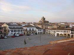
Garrovillas de Alconétar is a municipality located in the province of Cáceres, Extremadura, Spain. According to the 2005 census (INE), the municipality has a population of 2372 inhabitants.
Nearby are found the remains of the Roman Alconétar Bridge.
Coordinates: 39°42′N 6°33′W / 39.700°N 6.550°W
| Authority control |
|---|
This article is issued from
Wikipedia.
The text is licensed under Creative Commons - Attribution - Sharealike.
Additional terms may apply for the media files.