Garoua
| Garoua | |
|---|---|
| City | |
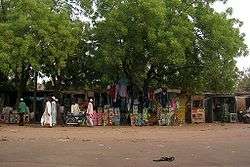 The Market at Garoua | |
 Garoua Location in Cameroon | |
| Coordinates: 9°18′N 13°24′E / 9.300°N 13.400°E | |
| Country |
|
| Region | North |
| Department | Bénoué |
| Elevation | 249 m (817 ft) |
| Population (2009) | |
| • Total | 600,000 |
| Climate | Aw |
Garoua or Garua (German: Garua) is a port city and the capital of the North Region of Cameroon, lying on the Benue River. A thriving centre of the textiles and cotton industries, the city has approximately 436,899 inhabitants in 2018.[1]
History
Garoua was established by the Fulani emir Modibbo Adama in the first half of the 19th century. During the steamship era, it developed into a major river port.[2]
Geography
Garoua is situated in northern Cameroon, and lies on the Benue River.[3] It serves as the gateway to Benoue National Park.[4] Neighborhoods include Commercial Centre, Lopere, Quartier de Marouaire, and the northwestern suburb of Yelwa, near Garoua International Airport.[3]
Climate
The average temperature in Garoua ranges from 26.0 °C (78.8 °F) in the January to 33.0 °C (91.4 °F) in April.
| Climate data for Garoua | |||||||||||||
|---|---|---|---|---|---|---|---|---|---|---|---|---|---|
| Month | Jan | Feb | Mar | Apr | May | Jun | Jul | Aug | Sep | Oct | Nov | Dec | Year |
| Average high °C (°F) | 34.4 (93.9) |
37.3 (99.1) |
39.8 (103.6) |
39.5 (103.1) |
36.5 (97.7) |
33.2 (91.8) |
31.1 (88) |
30.7 (87.3) |
31.5 (88.7) |
34.2 (93.6) |
36.0 (96.8) |
34.8 (94.6) |
34.9 (94.8) |
| Daily mean °C (°F) | 26.0 (78.8) |
28.9 (84) |
32.2 (90) |
33.0 (91.4) |
30.7 (87.3) |
28.2 (82.8) |
26.6 (79.9) |
26.4 (79.5) |
26.7 (80.1) |
28.1 (82.6) |
27.3 (81.1) |
26.0 (78.8) |
28.3 (82.9) |
| Average low °C (°F) | 17.5 (63.5) |
20.5 (68.9) |
24.7 (76.5) |
26.4 (79.5) |
24.9 (76.8) |
23.2 (73.8) |
22.2 (72) |
22.0 (71.6) |
21.9 (71.4) |
22.2 (72) |
19.2 (66.6) |
17.3 (63.1) |
21.8 (71.2) |
| Average precipitation mm (inches) | 0.0 (0) |
0.0 (0) |
2.0 (0.079) |
44.1 (1.736) |
108.4 (4.268) |
134.8 (5.307) |
205.3 (8.083) |
247.9 (9.76) |
190.0 (7.48) |
63.3 (2.492) |
1.6 (0.063) |
0.0 (0) |
997.4 (39.268) |
| Average precipitation days (≥ 1.0 mm) | 0 | 0 | 1 | 5 | 9 | 11 | 14 | 17 | 24 | 6 | 1 | 0 | 88 |
| Mean monthly sunshine hours | 275.0 | 252.6 | 260.1 | 245.4 | 256.7 | 224.4 | 194.0 | 187.2 | 204.5 | 261.5 | 279.2 | 286.5 | 2,927.1 |
| Source: NOAA[5] | |||||||||||||
Demographics
In 2005, Garoua had a population of 235,996 people. The city is inhabited by the Fulbe ethnic group.[6] Due to a significant number of Chadian expatriates in the city, there is a Chadian Consulate.[4]
Economy
As the fourth largest port in Cameroon,[7] Garoua is a major center of trade in the country.[8] It developed as a centre for trade in petroleum, cement, hides, peanuts, and cotton, transported on ships along the Benue River, between Burutu in Nigeria.[2] It has long been a thriving centre of the cotton industry and houses several textile processing facilities and factories.[9] The cotton company Sodecoton has one of its major centres in the city.[10] Leatherwork and fishing are also notable industries.[2]
Landmarks
Garoua has a Grand Mosque, known as the "Grande Mosquée de Poumpomeré".[3] The main sports stadium is the 35,000-seater Roumdé Adjia Stadium, the home ground of football club Coton Sport de Garoua.[11] There are several banks and insurance companies, a hospital, and a junior college.[2]
Transport
Garoua is served by Garoua International Airport, with the national airline operating, Cameroon Airlines. [12] The United States military uses the airport as a base to conduct unmanned aerial vehicle operations.[13] The city lies on National Highway 1,[3] at a junction of the road between Maroua and Ngaoundéré.[2] The main road leading north through the town and past the airport is called Rue de la Gendarmerie.[3]
Notable people
- Ahmadou Ahidjo, (1924-1989) first president of Cameroon[14]
- Eldridge Mohammadou (1934-2004) historian, professor at the Maiduguri university.[15]
References
- ↑ "Population of Cities in Cameroon (2018)". worldpopulationreview.com. Retrieved 2018-09-06.
- 1 2 3 4 5 "Garoua". Encyclopædia Britannica. Retrieved 29 October 2016.
- 1 2 3 4 5 Google (29 October 2016). "Garoua" (Map). Google Maps. Google. Retrieved 29 October 2016.
- 1 2 Ham, Anthony (2009). West Africa. Lonely Planet. p. 207. ISBN 978-1-74104-821-6.
- ↑ "Garoua Climate Normals 1961–1990". National Oceanic and Atmospheric Administration. Retrieved March 8, 2015.
- ↑ Drønen, Tomas Sundnes (31 August 2009). Communication and Conversion in Northern Cameroon: The Dii People and Norwegian Missionaries, 1934-1960. BRILL. p. 40. ISBN 978-90-474-3098-8.
- ↑ Trillo, Richard (2 June 2008). The Rough Guide to West Africa. Rough Guides Limited. p. 3028. ISBN 978-1-4053-8068-3.
- ↑ Georgia (Republic) Export-Import Trade and Business Directory. International Business Publications. October 2005. p. 97. ISBN 978-0-7397-3267-0.
- ↑ Ndenecho, Emmanuel Neba (2011). Decentralisation and Spatial Rural Development Planning in Cameroon. African Books Collective. p. 76. ISBN 978-9956-717-66-8.
- ↑ Raimond, Christine (8 October 2013). Ressources vivrières et choix alimentaires dans le bassin du lac Tchad. IRD Editions. p. 202. ISBN 978-2-7099-1576-2.
- ↑ Parrish, Charles; Nauright, John (21 April 2014). Soccer around the World: A Cultural Guide to the World's Favorite Sport. ABC-CLIO. p. 58. ISBN 978-1-61069-303-5.
- ↑ Africa Review 2003/04: The Economic and Business Report. Kogan Page Publishers. 2003. p. 44. ISBN 978-0-7494-4065-7.
- ↑ Hammer, Joshua (2016-02-25). "Hunting Boko Haram: The U.S. Extends Its Drone War Deeper Into Africa With Secretive Base". The Intercept.
- ↑ Appiah, Anthony; Gates, Henry Louis (2010). Encyclopedia of Africa. Oxford University Press. p. 73. ISBN 978-0-19-533770-9.
- ↑ "Eldridge Mohammadou (1934-2004)" (in French). Africanistes. 29 October 2016.
External links
![]()