Gannavaram
| Gannavaram | |
|---|---|
| Neighbourhood | |
 Gannavaram Location in Andhra Pradesh, India | |
| Coordinates: 16°32′00″N 80°48′00″E / 16.5333°N 80.8000°ECoordinates: 16°32′00″N 80°48′00″E / 16.5333°N 80.8000°E | |
| Country | India |
| State | Andhra Pradesh |
| District | Krishna |
| Elevation | 12 m (39 ft) |
| Population (2011)[1] | |
| • Total | 20,728 |
| Languages | |
| • Official | Telugu |
| Time zone | UTC+5:30 (IST) |
| PIN | 521101 |
| Telephone code | +91–8676 |
| Vehicle registration | AP–16 |
Gannavaram is a neighbourhood of Vijayawada in Krishna district of the Indian state of Andhra Pradesh. As per the G.O. No. M.S.104 (dated:23-03-2017), Municipal Administration and Urban Development Department, it became a part of Vijayawada metropolitan area.[2][3] It is also the mandal headquarters of Gannavaram mandal, administered under Nuzvid revenue division.[4][5]
Transport
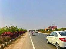
APSRTC operates buses from Gannavaram bus station which also has a bus depot.[6][7] Gannavaram railway station is one of the satellite railway stations of the Vijayawada.[8] The airport is located at Gannavaram 13 KM from Vijayawada.Road connectivity is available from Gannavaram to Vijayawada.
Education
The primary and secondary school education is imparted by government, aided and private schools, under the School Education Department of the state.[9][10] The medium of instruction followed by different schools are English, Telugu.
The National Institute of Disaster Management was planned to be set up at the village by the higher education department of the state.[11]
References
- ↑ "Census 2011". The Registrar General & Census Commissioner, India. Retrieved 14 September 2014.
- ↑ Reporter, Staff. "Vijayawada, 19 other contiguous areas notified as Metropolitan Area". The Hindu. Retrieved 27 March 2017.
- ↑ "Welcome to Government Order Issue Register". goir.ap.gov.in. Retrieved 27 March 2017.
- ↑ "Krishna District Mandals" (PDF). Census of India. pp. 495, 526–527. Retrieved 19 January 2015.
- ↑ "Administrative Setup". Krishna District Official Website. National Informatics Centre. Retrieved 9 February 2015.
- ↑ "Bus Stations in Districts". Andhra Pradesh State Road Transport Corporation. Archived from the original on 22 March 2016. Retrieved 8 March 2016.
- ↑ Sujatha Varma, P (7 February 2016). "RTC offers a 'sweet' journey". The Hindu. Vijayawada. Retrieved 8 March 2016.
- ↑ "Train services to be partially affected for nine days". The Hindu. Retrieved 20 April 2017.
- ↑ "School Education Department" (PDF). School Education Department, Government of Andhra Pradesh. Archived from the original (PDF) on 19 March 2016. Retrieved 7 November 2016.
- ↑ "The Department of School Education - Official AP State Government Portal | AP State Portal". www.ap.gov.in. Archived from the original on 7 November 2016. Retrieved 7 November 2016.
- ↑ Maitreyi, M. l Melly (20 February 2016). "Higher education institutions: State fast tracks process". The Hindu. Retrieved 23 September 2016.
| Wikimedia Commons has media related to Gannavaram. |