Athi-Galana-Sabaki River
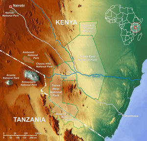
Athi-Galana-Sabaki River is the second longest river in Kenya (after the Tana River). It has a total length of 390 km, and drains a basin area of 70,000 km². The river rises at 1° 42′ S. as the Athi River and enters the Indian Ocean as Galana River (also known as Sabaki River).
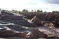
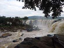
Athi River flows across the Kapote and Athi plains, through the Athi River town, takes a northeast direction and is met by the Nairobi River. Near Thika it forms the Fourteen Falls and turns south-south-east under the wooded slopes of the Yatta ridge, which shuts in its basin on the east. Apart from the numerous small feeders of the upper river, almost the only tributary is the Tsavo River, from the east side of Kilimanjaro, which enters in about 3° S. It turns east, and in its lower course, known as the Sabaki (or Galana), traverses the sterile quartz-land of the outer plateau. The valley is in parts low and flat, covered with forest and scrub, and containing small lakes and backwaters connected with the river in the rains. At this season the stream, which rises as much as 10 m in places, is deep and strong and of a turbid yellow colour; but navigation is interrupted by the Lugard falls, which is actually a series of rapids. Onwards it flows east and enters the Indian Ocean in 3° 10′ S., just 10km north of Malindi town.[1]
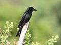
The river flows through the Tsavo East National Park and attracts diverse wildlife, including hippopotamus and crocodiles. Famously, in the 2009 case of Ben Nyaumbe, the region is also home to pythons.
References
- ↑
