Gadancourt
| Gadancourt | ||
|---|---|---|
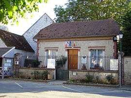 The town hall of Gadancourt | ||
| ||
 Gadancourt Location within Île-de-France region  Gadancourt | ||
| Coordinates: 49°05′49″N 1°51′28″E / 49.0969°N 1.8578°ECoordinates: 49°05′49″N 1°51′28″E / 49.0969°N 1.8578°E | ||
| Country | France | |
| Region | Île-de-France | |
| Department | Val-d'Oise | |
| Arrondissement | Pontoise | |
| Canton | Vauréal | |
| Area1 | 4.68 km2 (1.81 sq mi) | |
| Population (2006)2 | 104 | |
| • Density | 22/km2 (58/sq mi) | |
| Time zone | UTC+1 (CET) | |
| • Summer (DST) | UTC+2 (CEST) | |
| INSEE/Postal code | 95259 /95450 | |
| Elevation | 87–141 m (285–463 ft) | |
|
1 French Land Register data, which excludes lakes, ponds, glaciers > 1 km2 (0.386 sq mi or 247 acres) and river estuaries. 2 Population without double counting: residents of multiple communes (e.g., students and military personnel) only counted once. | ||

Gadancourt is a former commune in the Val-d'Oise department in Île-de-France in northern France. On 1 January 2018, it was merged into the commune of Avernes.[1]
See also
References
- Association of Mayors of the Val d’Oise (in French)
- ↑ Arrêté préfectoral 25 September 2017 (in French)
External links
| Wikimedia Commons has media related to Gadancourt. |
- Mérimée database - Cultural heritage (in French)
- Land use (IAURIF) (in English)
This article is issued from
Wikipedia.
The text is licensed under Creative Commons - Attribution - Sharealike.
Additional terms may apply for the media files.