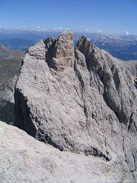
Furchetta
| Furchetta | |
|---|---|
 | |
| Highest point | |
| Elevation | 3,025 m (9,925 ft) |
| Prominence | 904 metres (2,966 ft) |
| Isolation | 10 kilometres (6.2 mi) |
| Listing | Alpine mountains above 3000 m |
| Coordinates | 46°36′46.1″N 11°46′24.6″E / 46.612806°N 11.773500°ECoordinates: 46°36′46.1″N 11°46′24.6″E / 46.612806°N 11.773500°E |
| Geography | |
| Location | South Tyrol, Italy |
| Parent range | Dolomites |
The Furchetta is a mountain of the Geisler group in the Dolomites in South Tyrol, Italy.
The Furchetta mountain is in the group of Odle and has been named after the great rift that divides it in two. The starting point of the mountain is in the Refuge Florence, which is reached in about 20 minutes from the mountain station of the gondola Santa Cristina Col Raiser.[1]
References
- Franz Moroder: Zur Topographie und Nomenclatur der Geisslerspitzen-Gruppe. Aus: Mitteilungen der Deutschen und Österreichischen Alpenvereins, Nr. 15, 1887
External links
![]()
This article is issued from
Wikipedia.
The text is licensed under Creative Commons - Attribution - Sharealike.
Additional terms may apply for the media files.