Fulton, Mississippi
| Fulton, Mississippi | |
|---|---|
| City | |
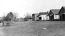
 Buildings along Main Street | |
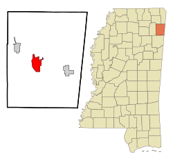 Location of Fulton, Mississippi | |
 Fulton, Mississippi Location in the United States | |
| Coordinates: 34°15′58″N 88°24′5″W / 34.26611°N 88.40139°WCoordinates: 34°15′58″N 88°24′5″W / 34.26611°N 88.40139°W | |
| Country | United States |
| State | Mississippi |
| County | Itawamba |
| Government | |
| • Mayor | Barry Childers |
| Area | |
| • Total | 8.7 sq mi (22.6 km2) |
| • Land | 8.5 sq mi (22.0 km2) |
| • Water | 0.2 sq mi (0.6 km2) |
| Elevation | 341 ft (104 m) |
| Population (2010) | |
| • Total | 3,961 |
| • Estimate (2016)[1] | 4,066 |
| • Density | 450/sq mi (180/km2) |
| Time zone | UTC-6 (Central (CST)) |
| • Summer (DST) | UTC-5 (CDT) |
| ZIP code | 38843 |
| Area code(s) | 662 |
| FIPS code | 28-26300 |
| GNIS feature ID | 0670269 |
Fulton is a city in and the county seat of Itawamba County, Mississippi, United States.[2] The population was 3,961 at the 2010 census.[3]
The city is part of the Tupelo Micropolitan Statistical Area.
History
Fulton was established in 1837 as a county seat for the newly-created Itawamba County. It is named for Robert Fulton, inventor of the steamboat.[4]
Geography
Fulton is located west of the center of Itawamba County at 34°15′58″N 88°24′5″W / 34.26611°N 88.40139°W (34.266110, -88.401358).[5] It is bordered to the west by the Tennessee–Tombigbee Waterway.
Interstate 22/U.S. Route 78 passes through the southern part of the city, with access from Exit 104 (S. Adams Street). I-22 leads west 19 miles (31 km) to Tupelo and east 25 miles (40 km) to Hamilton, Alabama. Mississippi Highway 25 passes through the southeastern part of Fulton, leading south 14 miles (23 km) to Smithville and north 26 miles (42 km) to Belmont.
According to the United States Census Bureau, Fulton has a total area of 8.7 square miles (22.6 km2), of which 8.5 square miles (22.0 km2) are land and 0.23 square miles (0.6 km2), or 2.46%, are water.[3]
Demographics
| Historical population | |||
|---|---|---|---|
| Census | Pop. | %± | |
| 1850 | 275 | — | |
| 1870 | 132 | — | |
| 1880 | 249 | 88.6% | |
| 1890 | 172 | −30.9% | |
| 1900 | 171 | −0.6% | |
| 1910 | 194 | 13.5% | |
| 1920 | 227 | 17.0% | |
| 1930 | 927 | 308.4% | |
| 1940 | 1,154 | 24.5% | |
| 1950 | 1,343 | 16.4% | |
| 1960 | 1,706 | 27.0% | |
| 1970 | 2,899 | 69.9% | |
| 1980 | 3,238 | 11.7% | |
| 1990 | 3,387 | 4.6% | |
| 2000 | 3,882 | 14.6% | |
| 2010 | 3,961 | 2.0% | |
| Est. 2016 | 4,066 | [1] | 2.7% |
| U.S. Decennial Census[6] | |||

As of the census[7] of 2000, there were 3,882 people, 1,357 households, and 891 families residing in the city. The population density was 450.3 people per square mile (173.9/km²). There were 1,508 housing units at an average density of 174.9 per square mile (67.5/km²). The racial makeup of the city was 83.69% White, 14.61% African American, 0.23% Native American, 0.52% Asian, 0.28% from other races, and 0.67% from two or more races. Hispanic or Latino of any race were 1.26% of the population.
There were 1,357 households out of which 26.5% had children under the age of 18 living with them, 48.3% were married couples living together, 13.9% had a female householder with no husband present, and 34.3% were non-families. 31.8% of all households were made up of individuals and 16.5% had someone living alone who was 65 years of age or older. The average household size was 2.29 and the average family size was 2.88.
In the city, the population was spread out with 18.7% under the age of 18, 21.3% from 18 to 24, 20.9% from 25 to 44, 19.3% from 45 to 64, and 19.8% who were 65 years of age or older. The median age was 35 years. For every 100 females, there were 83.5 males. For every 100 females aged 18 and over, there were 82.8 males.
The median income for a household in the city was $29,449, and the median income for a family was $42,287. Males had a median income of $33,490 versus $23,278 for females. The per capita income for the city was $15,540. About 9.7% of families and 16.9% of the population were below the poverty line, including 21.4% of those under age 18 and 17.2% of those age 65 or over.
Transportation
The historic Mississippian Railway provides rail service to local companies.
The Tennessee–Tombigbee Waterway provides water transportation for industries in Fulton.
Television broadcasting
- W39CA-D Channel 39 TV is a Unity Broadcasting Network station.
Education
Fulton is served by the Itawamba County School District.
Notable people
- Brian Dozier, baseball infielder for the Los Angeles Dodgers
- Jimmie Lunceford, jazz alto saxophonist and bandleader in the swing era
- Vernon Presley, father of Elvis Presley[8]
- Lyonel Thomas Senter Jr., U.S. federal judge
- Samuel M. Taylor, congressman from Arkansas
- Peggy Welch, member of the Indiana House of Representatives
References
| Wikimedia Commons has media related to Fulton, Mississippi. |
- 1 2 "Population and Housing Unit Estimates". Retrieved June 9, 2017.
- ↑ "Find a County". National Association of Counties. Archived from the original on 2011-05-31. Retrieved 2011-06-07.
- 1 2 "Geographic Identifiers: 2010 Census Summary File 1 (G001): Fulton city, Mississippi". American Factfinder. U.S. Census Bureau. Retrieved April 6, 2018.
- ↑ Mona Robinson Mills, Itawamba County (Arcadia Publishing, 2013), p. 8.
- ↑ "US Gazetteer files: 2010, 2000, and 1990". United States Census Bureau. 2011-02-12. Retrieved 2011-04-23.
- ↑ "Census of Population and Housing". Census.gov. Archived from the original on May 12, 2015. Retrieved June 4, 2015.
- ↑ "American FactFinder". United States Census Bureau. Archived from the original on 2013-09-11. Retrieved 2008-01-31.
- ↑ McDowell, Gary D. (2007-06-01). Mississippi Secrets: Facts, Legends, and Folklore. iUniverse. ISBN 9780595428373.
Municipalities and communities of Itawamba County, Mississippi, United States | ||
|---|---|---|
| City | 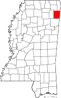 | |
| Towns | ||
| Unincorporated communities | ||
| Ghost towns | ||