Fruitland, Georgia
| Fruitland, Georgia | |
|---|---|
| Unincorporated community | |
 Fruitland Location within the state of Georgia  Fruitland Fruitland (the US) | |
| Coordinates: 30°49′25″N 82°51′17″W / 30.82361°N 82.85472°WCoordinates: 30°49′25″N 82°51′17″W / 30.82361°N 82.85472°W | |
| Country | United States |
| State | Georgia |
| County | Echols |
| Elevation | 161 ft (49 m) |
| Time zone | UTC-5 (Eastern (EST)) |
| • Summer (DST) | UTC-4 (EDT) |
| GNIS feature ID | 326295 |
Fruitland is an unincorporated community in northeastern Echols County, Georgia, United States. It lies on State Route 187 to the northeast of the unincorporated community of Statenville, the county seat of Echols County.[1] Its elevation is 161 feet (49 m).[2]
References
- ↑ Rand McNally. The Road Atlas '06. Chicago: Rand McNally, 2006, p. 29.
- ↑ U.S. Geological Survey Geographic Names Information System: Fruitland, Georgia, Geographic Names Information System, 1979-09-25. Accessed 2007-12-23.
Municipalities and communities of Echols County, Georgia, United States | ||
|---|---|---|
| CDP | 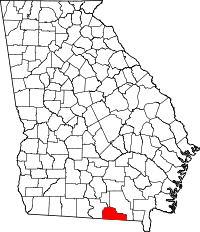 | |
| Unincorporated community | ||
This article is issued from
Wikipedia.
The text is licensed under Creative Commons - Attribution - Sharealike.
Additional terms may apply for the media files.