Friesack
| Friesack | ||
|---|---|---|
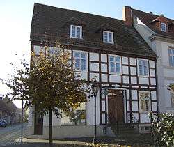 Museum and library | ||
| ||
 Friesack Location of Friesack within Havelland district 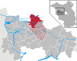 | ||
| Coordinates: 52°43′59″N 12°34′59″E / 52.73306°N 12.58306°ECoordinates: 52°43′59″N 12°34′59″E / 52.73306°N 12.58306°E | ||
| Country | Germany | |
| State | Brandenburg | |
| District | Havelland | |
| Municipal assoc. | Friesack | |
| Government | ||
| • Mayor | Klaus Gottschalk (SPD) | |
| Area | ||
| • Total | 83.67 km2 (32.31 sq mi) | |
| Elevation | 35 m (115 ft) | |
| Population (2017-12-31)[1] | ||
| • Total | 2,550 | |
| • Density | 30/km2 (79/sq mi) | |
| Time zone | CET/CEST (UTC+1/+2) | |
| Postal codes | 14662 | |
| Dialling codes | 033235 | |
| Vehicle registration | HVL | |
| Website | www.amt-friesack.de | |

Friesack is a town in the Havelland district, in Brandenburg, Germany. It is situated 22 km (14 mi) northeast of Rathenow, and 25 km (16 mi) southwest of Neuruppin. It is known for its Mesolithic archaeological site.
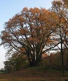
Seven Brothers Oak
Film shot in Friesack
- 1923 : Die Schlucht des Todes (The Ravine of Death) directed by Luciano Albertini and Albert-Francis Bertoni
Demography
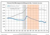
Development of population since 1875 within the current boundaries (Blue line: Population; Dotted line: Comparison to population development of Brandenburg state; Grey background: Time of Nazi rule; Red background: Time of communist rule)
| Friesack: Population development within the current boundaries (2017)[2] | ||||||||||||||||||||||||||||||||||||||||||||||||||||||||||||||||||||||||||||||||||||||||||||||||||||||||||||||||||||||||||||||||||||||
|---|---|---|---|---|---|---|---|---|---|---|---|---|---|---|---|---|---|---|---|---|---|---|---|---|---|---|---|---|---|---|---|---|---|---|---|---|---|---|---|---|---|---|---|---|---|---|---|---|---|---|---|---|---|---|---|---|---|---|---|---|---|---|---|---|---|---|---|---|---|---|---|---|---|---|---|---|---|---|---|---|---|---|---|---|---|---|---|---|---|---|---|---|---|---|---|---|---|---|---|---|---|---|---|---|---|---|---|---|---|---|---|---|---|---|---|---|---|---|---|---|---|---|---|---|---|---|---|---|---|---|---|---|---|---|
|
|
| ||||||||||||||||||||||||||||||||||||||||||||||||||||||||||||||||||||||||||||||||||||||||||||||||||||||||||||||||||||||||||||||||||||
Sons and daughters of the town
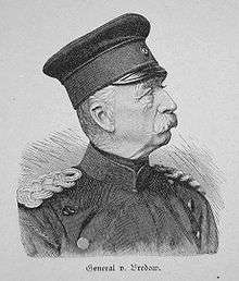
General von Bredow
- Emil Schallopp (1843-1919), chess master and writer
- Karsten Wettberg (born 1941), football coach
- Adalbert von Bredow (1814-1890), Prussian general
References
- ↑ "Bevölkerung im Land Brandenburg nach amtsfreien Gemeinden, Ämtern und Gemeinden 31. Dezember 2017 (Fortgeschriebene amtliche Einwohnerzahlen auf Grundlage des Zensus 2011)". Amt für Statistik Berlin-Brandenburg (in German). 2018.
- ↑ Detailed data sources are to be found in the Wikimedia Commons.Population Projection Brandenburg at Wikimedia Commons
Towns and municipalities in Havelland | ||
|---|---|---|
This article is issued from
Wikipedia.
The text is licensed under Creative Commons - Attribution - Sharealike.
Additional terms may apply for the media files.