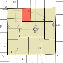
Franklin Township, Randolph County, Indiana
| Franklin Township | |
|---|---|
| Township | |
 | |
| Coordinates: 40°15′53″N 85°03′21″W / 40.26472°N 85.05583°WCoordinates: 40°15′53″N 85°03′21″W / 40.26472°N 85.05583°W | |
| Country | United States |
| State | Indiana |
| County | Randolph |
| Government | |
| • Type | Indiana township |
| Area | |
| • Total | 24 sq mi (60 km2) |
| • Land | 23.93 sq mi (62.0 km2) |
| • Water | 0.07 sq mi (0.2 km2) |
| Elevation[1] | 978 ft (298 m) |
| Population (2010) | |
| • Total | 1,265 |
| • Density | 52.9/sq mi (20.4/km2) |
| Time zone | UTC-5 (Eastern (EST)) |
| • Summer (DST) | UTC-4 (EDT) |
| Area code(s) | 765 |
| FIPS code | 18-25594[2] |
| GNIS feature ID | 453313 |
Franklin Township is one of eleven townships in Randolph County, Indiana. As of the 2010 census, its population was 1,265 and it contained 576 housing units.[3]
History
Franklin Township was established in 1859.[4]
Geography
According to the 2010 census, the township has a total area of 24 square miles (62 km2), of which 23.93 square miles (62.0 km2) (or 99.71%) is land and 0.07 square miles (0.18 km2) (or 0.29%) is water.[3]
Cities and towns
References
- ↑ "US Board on Geographic Names". United States Geological Survey. 2007-10-25. Retrieved 2008-01-31.
- ↑ "American FactFinder". United States Census Bureau. Archived from the original on 2013-09-11. Retrieved 2008-01-31.
- 1 2 "Population, Housing Units, Area, and Density: 2010 - County -- County Subdivision and Place -- 2010 Census Summary File 1". United States Census. Retrieved 2013-05-10.
- ↑ Tucker, E. (1882). History of Randolph County, Indiana: With Illustrations and Biographical Sketches of Some of Its Prominent Men and Pioneers : to which are Appended Maps of Its Several Townships. A.L. Klingman. p. 50.
External links
Municipalities and communities of Randolph County, Indiana, United States | ||
|---|---|---|
| Cities | ||
| Towns | ||
| Townships | ||
| Unincorporated communities | ||
| Footnotes | ‡This populated place also has portions in an adjacent county or counties | |
This article is issued from
Wikipedia.
The text is licensed under Creative Commons - Attribution - Sharealike.
Additional terms may apply for the media files.