Franklin Creek State Natural Area
| Franklin Creek State Natural Area | |
|---|---|
|
IUCN category III (natural monument or feature) | |
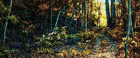 Franklin Creek State Park, October 2013 | |
 Map of the U.S. state of Illinois showing the location of Franklin Creek State Natural Area | |
| Location | Lee County, Illinois, USA |
| Nearest city | Franklin Grove, Illinois |
| Coordinates | 41°50′59″N 89°20′09″W / 41.84972°N 89.33583°WCoordinates: 41°50′59″N 89°20′09″W / 41.84972°N 89.33583°W |
| Area | 664 acres (269 ha) |
| Established | 1970 |
| Governing body | Illinois Department of Natural Resources |
Franklin Creek State Natural Area is an Illinois state park on 664 acres (269 ha) in Lee County, Illinois, United States. Franklin Creek State Natural Area was dedicated in 1982, making it the 24th nature preserve in Illinois.
References
- "Franklin Creek State Natural Area". Illinois Department of Natural Resources. Retrieved 2018-07-11.
- USGS. "Franklin Creek State Park, USGS Franklin Grove (IL) Quad". TopoQuest. Retrieved 2008-07-05.
This article is issued from
Wikipedia.
The text is licensed under Creative Commons - Attribution - Sharealike.
Additional terms may apply for the media files.