Franklin, Mississippi
| Franklin, Mississippi | |
|---|---|
| Unincorporated community | |
.jpg) Franklin Church, built 1841 | |
 Franklin  Franklin | |
| Coordinates: 33°02′09″N 90°00′07″W / 33.03583°N 90.00194°WCoordinates: 33°02′09″N 90°00′07″W / 33.03583°N 90.00194°W | |
| Country | United States |
| State | Mississippi |
| County | Holmes |
| Elevation | 331 ft (101 m) |
| Time zone | UTC-6 (Central (CST)) |
| • Summer (DST) | UTC-5 (CDT) |
| ZIP code | 39095 |
| Area code(s) | 662 |
| GNIS feature ID | 670157[1] |
Franklin is an unincorporated community located in Holmes County, Mississippi.[1] Mississippi Highway 17 passes through Franklin, which is approximately 7 miles (11 km) south of Lexington and approximately 12 miles (19 km) north of Pickens.
This was long an area of cotton plantations. In the antebellum era, labor was provided by enslaved African Americans. After the war, some freedmen worked the land as sharecroppers and tenant farmers.
History
In 1900, Franklin had a population of 80. It was an early place of European-American settlement and developing cotton plantations from the 1830s, after which most of the Choctaw people were removed to Indian Territory west of the Mississippi River. The American migrants were mostly from South Carolina and Virginia, and brought numerous slaves with them. Others they bought through the domestic slave trade.
The settlement had a post office in the early 1900s.[2]
Located a short distance east of the settlement is the Franklin Church and Cemetery.[3] Erected in 1841 from labor by enslaved African Americans, the church had two front entrances, one for men and one for women.[4]
On January 2, 1865, this was the site of a Civil War battle involving 3,300 Federal mounted troops and 1,100 Confederate Home Guards led by General William Wirt Adams. The Union Army won this battle and took numerous prisoners.[4][5] The church is still in use; cannonball holes from the Civil War have been left visible.[5]
References
- 1 2 U.S. Geological Survey Geographic Names Information System: Franklin
- ↑ Rowland, Dunbar (1907). Mississippi: Comprising Sketches of Counties, Towns, Events, Institutions, and Persons, Arranged in Cyclopedic Form. 1. Southern Historical Publishing Association. p. 742.
- ↑ "Franklin Church". Geographic Names Information System. United States Geological Survey.
- 1 2 "Pictorial History: Mississippi in Architecture". W.P.A. Historical Research Project. 1938.
- 1 2 "Historic Places Not On the National Register". United States National Park Service. Retrieved February 2016. Check date values in:
|accessdate=(help)
Municipalities and communities of Holmes County, Mississippi, United States | ||
|---|---|---|
| Cities | 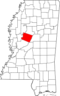 | |
| Towns | ||
| Unincorporated communities | ||