Fox Park, Wyoming
| Fox Park, Wyoming | |
|---|---|
| CDP | |
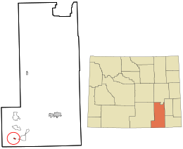 Location in Albany County and the state of Wyoming. | |
 Fox Park, Wyoming Location in the United States | |
| Coordinates: 41°4′46″N 106°9′9″W / 41.07944°N 106.15250°WCoordinates: 41°4′46″N 106°9′9″W / 41.07944°N 106.15250°W[1] | |
| Country |
|
| State |
|
| County |
|
| Area | |
| • Total | 1.0 sq mi (3 km2) |
| • Land | 1.0 sq mi (3 km2) |
| • Water | 0 sq mi (0 km2) |
| Elevation | 9,062 ft (2,762 m) |
| Population (2010)[2] | |
| • Total | 22 |
| • Density | 22/sq mi (8.5/km2) |
| Time zone | UTC-7 (Mountain (MST)) |
| • Summer (DST) | UTC-6 (MDT) |
| Area code(s) | 307 |
| FIPS code | 56-29390[3] |
| GNIS feature ID | 1599838[4] |
Fox Park is a census-designated place (CDP) in Albany County, Wyoming, United States. The population was 22 at the 2010 census.
Geography
According to the United States Census Bureau, the CDP has a total area of 1.0 square miles (28.5 km²), all of which was land.[5]
The CDP is located entirely within the Medicine Bow National Forest.
Education
Public education in the community of Albany is provided by Albany County School District #1.
References
- ↑ "US Gazetteer files: 2010, 2000, and 1990". United States Census Bureau. 2011-02-12. Retrieved 2011-04-23.
- ↑ "2010 City Population and Housing Occupancy Status". U.S. Census Bureau. Archived from the original on July 21, 2011. Retrieved June 4, 2013.
- ↑ "American FactFinder". United States Census Bureau. Archived from the original on 2013-09-11. Retrieved 2008-01-31.
- ↑ "US Board on Geographic Names". United States Geological Survey. 2007-10-25. Retrieved 2008-01-31.
- ↑ "2010 Wyoming Place Names". U.S. Census Bureau. Retrieved June 4, 2013.
Municipalities and communities of Albany County, Wyoming, United States | ||
|---|---|---|
| City | 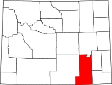 | |
| Town | ||
| CDPs | ||
| Unincorporated communities | ||
This article is issued from
Wikipedia.
The text is licensed under Creative Commons - Attribution - Sharealike.
Additional terms may apply for the media files.