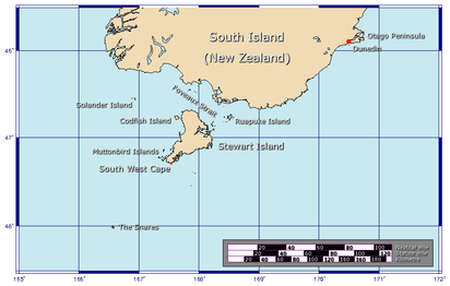
Foveaux Strait
Foveaux Strait (Te Ara a Kiwa ("the path of Kiwa") or Te Ara a Kewa ("the path of the whale"[1]) (Māori) separates Stewart Island/Rakiura, New Zealand's third largest island, from the South Island.[2] According to a Maori legend, the strait was created by Kewa the obedient whale when traditional Maori ancestor Kiwa summoned the whale to create a waterway.[3] Three large bays, Te Waewae Bay, Oreti Beach and Toetoes Bay, sweep along the strait's northern coast, which also hosts Bluff township and harbour. Across the strait lie the Solander Islands, Stewart Island/Rakiura, Dog Island and Ruapuke Island. The strait is about 130 km long (from Ruapuke Island to Little Solander Island), and it widens (from 14 km at Ruapuke Island to 50 km at Te Waewae Bay) and deepens (from 20 to 120 m) from east to west. The strait lies within the continental shelf area of New Zealand, and was probably dry land during the Pleistocene epoch.[4]
Captain Cook sighted Foveaux Strait during his circumnavigation of the South Island in March 1770, but decided to hide it. He was obeying the usual instructions of the British Admiralty to conceal strategic features - such as off-shore islands - from Britain's rivals, notably the French. Consequently, Cook amended both his journal and chart to depict Stewart Island as a peninsula.[5]
The strait's next European discoverer was Owen Folger Smith, who found it in 1804. It is named after Joseph Foveaux, Lieutenant-Governor of New South Wales in 1808–1809.[4]

Foveaux Strait is home to the Bluff oyster fishery, the oysters are harvested by a fleet of dredging boats - mostly operating from Bluff Harbour in the South Island - between March and August each year.[6] Oystering began on Stewart Island during the 1860s, and gradually moved into the strait with the discovery of larger oyster beds there in 1879.[7]
The strait is a rough and often treacherous stretch of water. In 2006, six muttonbirders died when their trawler sank while returning to Bluff. From the years 1998 to 2012 there were a total of 23 fatalities in the Strait.[8]
John van Leeuwen swam it on 7 February 1963, in a time of 13 hours 40 minutes.[4]
References
- ↑ Whales and Māori society - Whale place names and imagery
- ↑ "Place name detail: Foveaux Strait". New Zealand Gazetteer. Land Information New Zealand. Retrieved 2009-03-28.
- ↑ http://www.doc.govt.nz/Documents/about-doc/role/policies-and-plans/southland/southland-cms-2016-volume%201.pdf
- 1 2 3 "Foveaux Strait". An Encyclopaedia of New Zealand. 1966. Retrieved 5 March 2010.
- ↑ Cameron-Ash, M. (2018). Lying for the Admiralty. Sydney: Rosenberg. ISBN 9780648043966.
- ↑ "High demand for recession-proof oysters". New Zealand Herald. 2 March 2009. Retrieved 2009-03-02.
- ↑ "Bluff Oysters & Oystering". Bluff Promotions. Archived from the original on 5 March 2010. Retrieved 5 March 2010.
- ↑ Rudd, Allison (2012-12-07). "Memorial planned for those lost in Foveaux". Otago Daily Times. Allied Press Limited 2007. Retrieved 2012-12-11.
Coordinates: 46°40′S 168°11′E / 46.67°S 168.18°E
| Authority control |
|---|