Fort Meade, Florida
| Fort Meade, Florida | ||
|---|---|---|
| City | ||
| City of Fort Meade | ||
 Christ Church built in 1889. | ||
| ||
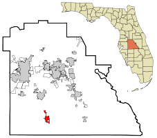 Location in Polk County and the state of Florida | ||
| Coordinates: 27°45′6″N 81°47′48″W / 27.75167°N 81.79667°WCoordinates: 27°45′6″N 81°47′48″W / 27.75167°N 81.79667°W | ||
| Country | United States | |
| State | Florida | |
| County | Polk | |
| Settled | 1849 | |
| Government | ||
| • City Manager | Fred Hilliard | |
| Area[1] | ||
| • City | 8.64 sq mi (22.38 km2) | |
| • Land | 8.27 sq mi (21.42 km2) | |
| • Water | 0.37 sq mi (0.96 km2) | |
| Elevation | 138 ft (42 m) | |
| Population (2010) | ||
| • City | 5,626 | |
| • Estimate (2016)[2] | 6,035 | |
| • Density | 729.66/sq mi (281.72/km2) | |
| • Metro | 584,383 | |
| Time zone | UTC-5 (Eastern (EST)) | |
| • Summer (DST) | UTC-4 (EDT) | |
| ZIP code | 33841 | |
| Area code(s) | 863 | |
| FIPS code | 12-24100[3] | |
| GNIS feature ID | 0282697[4] | |
| Website |
www | |
Fort Meade is a city in Polk County, Florida, United States. The population was 5,691 at the 2000 census. As of 2004, the population recorded by the U.S. Census Bureau is 5,761.[5] It is part of the Lakeland–Winter Haven Metropolitan Statistical Area. The city was named for George Meade, at the time an Army lieutenant serving in Florida following the Second Seminole War.[6] Fort Meade is home to Fort Meade Middle-Senior High School, several historic buildings, Streamsong resort and Patterson Park. The area is popular with kayakers and canoers.
History
Fort Meade is the oldest city in Polk County, dating its origins to 1849 when it was established along a new military road from Tampa (Fort Brooke) to Fort Pierce following the Second Seminole War. The town and road were originally sited by then-lieutenant George Meade of the Corps of Topographical Engineers, whose commander named it for him.[7] The 1880s business district was located on old Wire Street (now Broadway), which was a casualty of four devastating fires. Today, there are over 150 buildings which are designated as landmarks.[8] In the 1890s the Fort Meade Street Railway operated a horse-drawn service in the town.
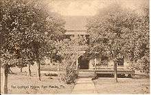
The earliest known burial is John I. Hooker (1821–1862) located in the town's Evergreen Cemetery. Fort Meade's Christ Church (Episcopal) located at 526 North Oak, was built in 1889. It is a frame vernacular with Gothic Revival elements and was designed by architect J. H. Weddell. A minister named C.E Butler had committed suicide at the church in 1894. Located next to Christ Church is the famous Rev. Wm James Reid House. Located within the historic district, the house was used for the HBO motion picture Judgment, featuring Blythe Danner, Keith Carradine and Jack Warden (1990).
Future Confederate General Stonewall Jackson was stationed at the fort in 1851.[9] The town was burned by Union forces in 1864[10] and all of the original structures were destroyed, except the second fort which was dismantled in the 1890s. Fort Meade has over 300 homes on the National Register of Historic Places and a handful that date to the late 1800s.
Historic homes and buildings
- Old Fort Meade School House Museum, c. 1885.
- Rev. Wm James Reid House, c. 1900.
- W.O. Williams/R.C. McClellan House, c. 1898.
Geography and climate
Fort Meade is located at 27°45′06″N 81°47′48″W / 27.751628°N 81.796767°W (27.751628, -81.796767).[11] Fort Meade is located 20 miles southwest of Legoland in Winter Haven. Fort Meade is located within the Central Florida Highlands area of the Atlantic coastal plain, with a terrain consisting of flatland interspersed with gently rolling hills.[12]
According to the United States Census Bureau, the city has a total area of 13.0 km2 (5.0 mi2), of which 12.9 km2 (5.0 mi2) is land and 0.1 km2 (0.1 mi2) (1.00%) is water.
Fort Meade is located in the humid subtropical zone, as designated by (Köppen climate classification: Cfa).[13]
Economy
Economic growth has been evident in Fort Meade. Mosaic Corporation developed a world class 10,000 acre golf and spa resort named Streamsong nearby. Legoland opened on October 15, 2011, and is having an economic impact on Fort Meade and the surrounding areas. Many of the historic homes are being purchased and restored despite a depressed Florida real estate market.[14]
Demographics
| Historical population | |||
|---|---|---|---|
| Census | Pop. | %± | |
| 1880 | 105 | — | |
| 1890 | 267 | 154.3% | |
| 1900 | 261 | −2.2% | |
| 1910 | 1,165 | 346.4% | |
| 1920 | 2,029 | 74.2% | |
| 1930 | 1,981 | −2.4% | |
| 1940 | 1,992 | 0.6% | |
| 1950 | 2,803 | 40.7% | |
| 1960 | 4,014 | 43.2% | |
| 1970 | 4,374 | 9.0% | |
| 1980 | 5,546 | 26.8% | |
| 1990 | 4,976 | −10.3% | |
| 2000 | 5,691 | 14.4% | |
| 2010 | 5,626 | −1.1% | |
| Est. 2016 | 6,035 | [2] | 7.3% |
| U.S. Decennial Census[15] | |||
As of the census[3] of 2000, there were 5,691 people, 2,068 households, and 1,528 families residing in the city. The population density was 441.2/km2 (1,143.8/mi2). There were 2,625 housing units at an average density of 203.5/km2 (527.6/mi2). The racial makeup of the city was 67.60% White, 21.84% African American, 0.40% Native American, 0.09% Asian, 9.21% from other races, and 0.86% from two or more races. Hispanic or Latino of any race were 17.17% of the population.
There were 2,068 households out of which 31.8% had children under the age of 18 living with them, 52.7% were married couples living together, 16.4% had a female householder with no husband present, and 26.1% were non-families. 22.2% of all households were made up of individuals and 11.5% had someone living alone who was 65 years of age or older. The average household size was 2.72 and the average family size was 3.16.
In the city, the population was spread out with 28.4% under the age of 18, 8.5% from 18 to 24, 24.9% from 25 to 44, 20.4% from 45 to 64, and 17.8% who were 65 years of age or older. The median age was 36 years. For every 100 females, there were 95.2 males. For every 100 females age 18 and over, there were 89.2 males.
The median income for a household in the city was $32,984, and the median income for a family was $38,125. Males had a median income of $30,617 versus $21,813 for females. The per capita income for the city was $15,499. About 15.0% of families and 18.3% of the population were below the poverty line, including 30.9% of those under age 18 and 8.2% of those age 65 or over.
In 2010 Fort Meade had a population of 5,626. The racial and ethnic composition of the population was 68.29% non-Hispanic white, 18.24% black or African American, 0.5% Native American, 0.3% Asian, 0.4% non-Hispanic from some other race, 1.9% reporting two or more races and 26.1% Hispanic or Latino. Most of the Hispanic population was Mexican with Mexicans making up 23.5% of the total population.[16]
Notable people
- Melony Bell, politician
- Onterio McCalebb, former Auburn University running back and current cornerback for the Cincinnati Bengals
- Andrew McCutchen, San Francisco Giants outfielder, was born and raised in Fort Meade.[17]
Designated a Blueway community
As of July 20, 2011, Fort Meade officially became only the second city in all of Florida to be designated as a "Blueway" community by the Florida Paddlers Association. Fort Meade Outdoor Recreation Area is a popular launching and pick-up site for kayak and canoe enthusiasts and is the site for the annual Peace River Paddle hosted by Florida Paddlers.[18]
Media
Fort Meade is part of the Tampa/St. Pete television market, the 13th largest in the country, and part of the local Lakeland/Winter Haven radio market, which is the 94th largest in the country.[19][20]
Transportation
Major highways in Fort Meade:
- US 17 - North/south highway on the middle of town. North of town it leads to Bartow. Southbound leads to Wauchula.
- US 98 - Co-signed with US 17 on the north side of town, US 98 turns eastbound at East Broadway Avenue and leads to Frostproof and US 27.
References
- ↑ "2016 U.S. Gazetteer Files". United States Census Bureau. Retrieved Jul 7, 2017.
- 1 2 "Annual Estimates of the Resident Population: April 1, 2010 - July 1, 2016: Incorporated places: Florida". American Fact Finder. U.S. Census Bureau. Retrieved 18 November 2017.
- 1 2 "American FactFinder". United States Census Bureau. Retrieved 2008-01-31.
- ↑ "US Board on Geographic Names". United States Geological Survey. 2007-10-25. Retrieved 2008-01-31.
- ↑ U.S. Census Bureau. "Table 4: Annual estimates of the population for incorporated places in Florida". Archived from the original (xls) on 22 July 2007. Retrieved 22 July 2007.
- ↑ Whitehead, Bill (14 August 1960). "First Polk Settlers Had to Build Towns, Then Name Them". Lakeland Ledger. pp. 7-A. Retrieved 22 April 2015.
- ↑ Brown, Canter, Jr. (1991). "Moving a military road" (PDF). South Florida History Magazine. No. 2. pp. 8–11 – via HistoryMiami.
Twiggs ... caused the post to be named Fort Meade.
- ↑ "Historical Highlights" (PDF). Polk County Historical Quarterly. Polk County Historical Association. September 1994. p. 7. Archived from the original (PDF) on 2012-03-05. Retrieved 2010-10-01.
- ↑ Gwynne, S. C. (2014). Rebel Yell: The Violence, Passion, and Redemption of Stonewall Jackson. New York: Scriber. pp. 110–8.
- ↑ "Map of Civil War, Polk County" (PDF). Polk County Historical Quarterly. Polk County Historical Association. June 2003. p. 12. Archived from the original (PDF) on 2 April 2012. Retrieved 26 September 2010.
- ↑ "US Gazetteer files: 2010, 2000, and 1990". United States Census Bureau. 2011-02-12. Retrieved 2011-04-23.
- ↑ "Florida's Geological History". University of Florida. Retrieved 2010-10-14.
- ↑ "World Map of the Köppen-Geiger climate classification updated". University of Veterinary Medicine Vienna. 2008-11-06. Archived from the original on 2010-09-06. Retrieved 2010-09-10.
- ↑ "Streamsong Resort". Streamsong Resort. 2011. p. 6. Retrieved 2011-07-11.
- ↑ "Census of Population and Housing". Census.gov. Archived from the original on 12 May 2015. Retrieved 4 June 2015.
- ↑ 2010 general demographic report for Fort Meade city
- ↑ "Andrew McCutchen Statistics and History - Baseball-Reference.com". baseball-reference.com. Retrieved May 8, 2011.
- ↑ "Blueway designation could lead to the green - Fortmeadeleader.com". Fort Meade Leader. Retrieved 20 July 2011.
- ↑ "Top Nielsen Markets". TV By the Numbers. Retrieved 19 October 2010.
- ↑ "Arbitron Markets". Arbitron. Retrieved 19 October 2010.
Further reading
- Brown, Canter, Jr. (1991). "Moving a military road" (PDF). South Florida History Magazine (2). pp. 8–11 – via HistoryMiami.
External links
| Wikivoyage has a travel guide for Fort Meade, Florida. |
Municipalities and communities of Polk County, Florida, United States | ||
|---|---|---|
| Cities | 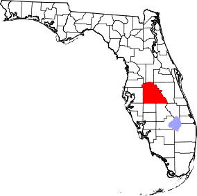 | |
| Towns | ||
| Village | ||
| CDPs | ||
| Unincorporated communities | ||
| Ghost town | ||
| Footnotes | ‡This populated place also has portions in an adjacent county or counties | |