Fort Landing, North Carolina
| Fort Landing | |
|---|---|
| Unincorporated community | |
 Fort Landing Location within the state of North Carolina | |
| Coordinates: 35°56′41″N 76°03′51″W / 35.94472°N 76.06417°WCoordinates: 35°56′41″N 76°03′51″W / 35.94472°N 76.06417°W | |
| Country | United States |
| State | North Carolina |
| County | Tyrrell County |
| Elevation | 3 ft (0.9144 m) |
| Time zone | UTC-5 (Eastern (EST)) |
| • Summer (DST) | UTC-4 (EDT) |
| ZIP code | 27925 |
| Area code(s) | 252 |
| GNIS feature ID | 1020330[1] |
Fort Landing is an unincorporated community in Tyrrell County, North Carolina, United States. The community is located on the western banks of the Little Alligator River/East Lake; 13 miles (21 km) east of Columbia. From 1932-1951, Fort Landing was the eastern terminus of US 64.[2]
References
Municipalities and communities of Tyrrell County, North Carolina, United States | ||
|---|---|---|
| Town | 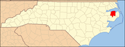 | |
| Unincorporated communities | ||
This article is issued from
Wikipedia.
The text is licensed under Creative Commons - Attribution - Sharealike.
Additional terms may apply for the media files.