Forsand (village)
| Forsand | |
|---|---|
| Village | |
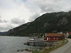 View of the village coastline | |
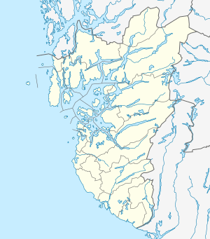 Forsand Location in Rogaland county  Forsand Forsand (Norway) | |
| Coordinates: 58°54′11″N 06°06′17″E / 58.90306°N 6.10472°ECoordinates: 58°54′11″N 06°06′17″E / 58.90306°N 6.10472°E | |
| Country | Norway |
| Region | Western Norway |
| County | Rogaland |
| District | Ryfylke |
| Municipality | Forsand |
| Area[1] | |
| • Total | 0.69 km2 (0.27 sq mi) |
| Elevation[2] | 32 m (105 ft) |
| Population (2015)[1] | |
| • Total | 497 |
| • Density | 720/km2 (1,900/sq mi) |
| Time zone | UTC+01:00 (CET) |
| • Summer (DST) | UTC+02:00 (CEST) |
| Post Code | 4110 Forsand |
Forsand is the administrative centre of Forsand Municipality in Rogaland county, Norway. The village is located along the Høgsfjorden, at the mouth of the 42-kilometre (26 mi) long Lysefjorden, on the southern side of the fjord. The Lysefjord Bridge is located just northeast of Forsand village and it crosses the Lysefjorden, connecting it to the small village of Oanes which sits on the north side of the fjord. The village of Høle is located across the Høgsfjorden to the west. Høle is connected to Forsand-Oanes by a regular ferry connection.[3]
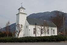
The 0.69-square-kilometre (170-acre) village has a population (2015) of 497, giving the village a population density of 720 inhabitants per square kilometre (1,900/sq mi).[1] The Lysefjord Bridge crosses the fjord to the north of the village. The village of Forsand has two grocery stores, the local government offices, Forsand Church, and Forsand School.
References
- 1 2 3 Statistisk sentralbyrå (1 January 2015). "Urban settlements. Population and area, by municipality".
- ↑ "Forsand, Forsand (Rogaland)" (in Norwegian). yr.no. Retrieved 2016-02-19.
- ↑ Godal, Anne Marit (ed.). "Forsand – tettsted". Store norske leksikon (in Norwegian). Oslo: Norsk nettleksikon. Retrieved 13 October 2013.