Fond-du-Lac
| Fond du Lac | |
|---|---|
 Fond du Lac main street 1926 | |
| Nickname(s): fdl | |
 Fond du Lac Location of Fond du Lac in Saskatchewan | |
| Coordinates: 59°19′12.8″N 107°11′46.9″W / 59.320222°N 107.196361°W | |
| Country | Canada |
| Province | Saskatchewan |
| Government | |
| • Chief | Louie Mercredi |
| • MLA Athabasca | Buckley Belanger |
| • MP Desnethé—Missinippi—Churchill River | Georgina Jolibois |
| Area | |
| • Total | 138.26 km2 (53.38 sq mi) |
| Population (2011)[1] | |
| • Total | 874 |
| • Density | 6.3/km2 (16/sq mi) |
| Time zone | UTC−6 (Central Standard Time) |
| • Summer (DST) | UTC−5 |
| Postal code | S0J 0W0 |
| [2][3][4] | |
Fond-du-Lac is a settlement of the Fond du Lac Dene Nation located in the boreal forest area of northern Saskatchewan, Canada. Situated on the east side of Lake Athabasca, it is a remote fly-in community. The population in 2011 was 874,[1] mainly of Dene and Métis descent. 705 residents selected Dene as their mother tongue in 2011.[1]
Fond du Lac is a geographic name meaning "far end of the lake" in the French language (literally it translates as "bottom of the lake").[5][6]
History
.jpg)
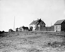
Founded as a community over 150 years ago, by Denesuline First Nations in pursuit of furs, fishing, hunting and trapping the community has seen little changes. Many in the community can trace their ancestral roots to the early 19th century. "Living off the land" is still a way of life in Fond-du-Lac.[7]
Many of the residents are descendants of the Maurice's Band who signed an adhesion to Treaty 8 in 1899. The Maurice's Band (Chief Maurice Piche's Band) split in 1949 forming the Fond-du-Lac Band and the Black Lake Band.[7]
Fond du Lac Dene Nation
Fond du Lac Dene Nation is a First Nation band government with 6 territories around the eastern area of Lake Athabasca.[1][8][9]
- Fond du Lac 227 is 15,520 hectares (38,400 acres) 59°20′55″N 106°58′22″W / 59.3485°N 106.9729°W on the north shore of Lake Athabasca and contains the village of Fond du Lac.
- Fond du Lac 228 is 1,082.5 hectares (2,675 acres) 59°18′00″N 107°12′23″W / 59.2999°N 107.2063°W across the lake from the village.
- Fond du Lac 229 is 7,821.1 hectares (19,326 acres) 59°26′02″N 107°42′45″W / 59.4338°N 107.7124°W west of the village on the north shore of the lake. Population 0 in 2011.
- Fond du Lac 231 is 2,023.5 hectares (5,000 acres) 59°07′20″N 107°54′09″W / 59.1222°N 107.9026°W borders the Athabasca Sand Dunes Provincial Park on the McFarlane River. Population 0 in 2011.
- Fond du Lac 232 is 2,023.5 hectares (5,000 acres) 59°08′28″N 107°24′39″W / 59.1410°N 107.4107°W on the Otherside River east of Fond du Lac 231. Population 0 in 2011.
- Fond du Lac 233 is 8,341.5 hectares (20,612 acres) 59°16′35″N 107°16′33″W / 59.2764°N 107.2757°W on the south side of the lake surrounding Fond du Lac 228. Population 0 in 2011.
Fond du Lac had a total registered membership of 1,895 with 1,066 members residing on-reserve and 829 members residing at locations off-reserve in September 2013.[10] The Fond du Lac First Nation is a member of the Prince Albert Grand Council.[11]
Demographics
| Canada census – Fond-du-Lac community profile | |||
|---|---|---|---|
| 2011 | 2006 | ||
| Population: | 874 (+9.1% from 2006) | 801 (+17.4% from 2001) | |
| Land area: | 138.26 km2 (53.38 sq mi) | 138.26 km2 (53.38 sq mi) | |
| Population density: | 6.3/km2 (16/sq mi) | 5.8/km2 (15/sq mi) | |
| Median age: | 22.9 (M: 22.3, F: 23.4) | 19.9 (M: 19.8, F: 20.2) | |
| Total private dwellings: | 229 | 182 | |
| Median household income: | |||
| References: 2011[12] 2006[13] earlier[14] | |||
Economy
The main enterprise today in Fond du Lac is working in the mineral and other resource extraction business. Others follow a tradition of fishing, hunting, and trapping as well as providing guide services to the many fishing camps in the area.
Transportation
There are minimal roads within the community and no year-round roads to the community. It is only accessible by air (through the Fond-du-Lac Airport), inland water transport and snowmobile.[15] Common transportation for community members includes driving large trucks and ATVs better known as four wheelers. In the winter there is a seasonal ice road with access to Uranium City and Stony Rapids (with the latter community in turn connected to the rest of the province via another ice road). The community greatly relies on aircraft and barges for supplies and services. In the winter the occasional truck will venture in on the ice road with supplies.
Climate
| Climate data for Fond-du-Lac | |||||||||||||
|---|---|---|---|---|---|---|---|---|---|---|---|---|---|
| Month | Jan | Feb | Mar | Apr | May | Jun | Jul | Aug | Sep | Oct | Nov | Dec | Year |
| Average high °C (°F) | −24 (−11) |
−20 (−4) |
−12 (10) |
0 (32) |
9 (48) |
17 (62) |
20 (68) |
18 (64) |
11 (51) |
2 (35) |
−9 (15) |
−17 (2) |
0 (31) |
| Daily mean °C (°F) | −28 (−18) |
−25 (−13) |
−18 (0) |
−6 (21) |
4 (39) |
11 (51) |
15 (59) |
13 (55) |
7 (44) |
0 (32) |
−12 (10) |
−23 (−9) |
−5 (23) |
| Average low °C (°F) | −32 (−25) |
−30 (−22) |
−24 (−11) |
−12 (10) |
−1 (30) |
5 (41) |
10 (50) |
8 (46) |
2 (35) |
−3 (26) |
−15 (5) |
−26 (−14) |
−10 (14) |
| Average precipitation mm (inches) | 20 (0.8) |
15 (0.6) |
18 (0.7) |
18 (0.7) |
20 (0.8) |
36 (1.4) |
51 (2.0) |
48 (1.9) |
36 (1.4) |
33 (1.3) |
28 (1.1) |
20 (0.8) |
343 (13.5) |
| Source: http://www.weatherbase.com/weather/weather.php3?s=710762 | |||||||||||||
Entertainment
Fond-du-Lac is referenced in the song "Live Oak" by Jason Isbell on the album Southeastern, which was released in 2013.
References
- 1 2 3 4 "2011 Community Profiles". Statistics Canada. Government of Canada. Retrieved 2013-04-05.
- ↑ National Archives, Archivia Net. "Post Offices and Postmasters". Archived from the original on 2006-10-06. Retrieved 2013-04-05.
- ↑ Government of Saskatchewan, MRD Home. "Municipal Directory System". Archived from the original on 2016-01-15. Retrieved 2013-04-05.
- ↑ Commissioner of Canada Elections, Chief Electoral Officer of Canada (2005). "Elections Canada On-line". Archived from the original on 2007-04-21. Retrieved 2013-04-05.
- ↑ "Dictionary of Wisconsin History". Wisconsin Historical Society. Retrieved 2008-10-20.
- ↑ Clorissa Swingen (Spring 1988). "Fond du Lac: Links to our Past". Retrieved 2007-03-20.
- 1 2 "Prince Albert Grand Council (Fond-du-Lac)". Archived from the original on 2013-05-03. Retrieved 2013-03-02.
- ↑ "AANDC (First Nation Detail)". Archived from the original on 2013-10-17. Retrieved 2013-10-15.
- ↑ "Natural Resources Canada-Canadian Geographical Names (Query by Geographical Name)". Retrieved 2015-02-04.
- ↑ "AANDC (Registered Population)". Archived from the original on 2016-03-04. Retrieved 2012-10-17.
- ↑ "Prince Albert Grand Council". Archived from the original on 2012-02-12. Retrieved 2013-03-02.
- ↑ "2011 Community Profiles". Canada 2011 Census. Statistics Canada. July 5, 2013. Retrieved 2012-06-02.
- ↑ "2006 Community Profiles". Canada 2006 Census. Statistics Canada. March 30, 2011. Retrieved 2012-06-02.
- ↑ "2001 Community Profiles". Canada 2001 Census. Statistics Canada. February 17, 2012.
- ↑ "Google Maps". Retrieved 2013-03-02.
External links
Coordinates: 59°19′N 107°11′W / 59.317°N 107.183°W
| Numbered Treaties | |
|---|---|
| Saskatchewan | |
| Alberta |
|
| British Columbia | |
| Northwest Territories |
|