Foel Grach
| Foel Grach | |
|---|---|
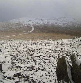 Foel Grach from Garnedd Uchaf in November 2008. | |
| Highest point | |
| Elevation | 975 m (3,199 ft) |
| Prominence | 42 m (138 ft) |
| Parent peak | Carnedd Llewelyn |
| Listing | Hewitt, Welsh 3000s, Nuttall |
| Coordinates | 53°10′27″N 3°57′48″W / 53.17417°N 3.96333°WCoordinates: 53°10′27″N 3°57′48″W / 53.17417°N 3.96333°W |
| Naming | |
| Translation | scabby hill (Welsh) |
| Pronunciation | Welsh: [ˈvɔil ˈɡɾɑːx] |
| Geography | |
| Location | Conwy / Gwynedd, Wales |
| Parent range | Snowdonia |
| OS grid | SH689659 |
| Topo map | OS Landranger 115 |
| Listed summits of Foel Grach | ||||
| Name | Grid ref | Height | Status | |
|---|---|---|---|---|
| Craig Eigiau | 735 metres (2,411 ft) | sub Hewitt, Nuttall | ||
Foel Grach is a mountain in the Carneddau range, is the eighth-highest summit in Snowdonia as well as Wales, and included in the Welsh 3000s.
It is located on a broad ridge extending northwards from Carnedd Llewelyn to Carnedd Gwenllian (formerly Garnedd Uchaf) and Foel-fras. An emergency refuge has been built beneath the summit. Compared to the surrounding mountains much deeper snow takes place due to its rather broad summit and high grassy slopes. On clear days the Isle of Man and even the Mourne Mountains in Northern Ireland can be seen from the summit.[1]
References
External links
This article is issued from
Wikipedia.
The text is licensed under Creative Commons - Attribution - Sharealike.
Additional terms may apply for the media files.