Floreat, Western Australia
| Floreat Perth, Western Australia | |||||||||||||||
|---|---|---|---|---|---|---|---|---|---|---|---|---|---|---|---|
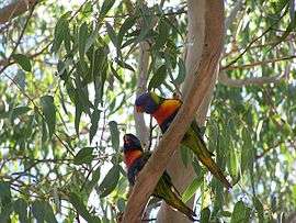 Rainbow lorikeets at Perry Lakes | |||||||||||||||
 Floreat | |||||||||||||||
| Coordinates | 31°56′17″S 115°47′38″E / 31.938°S 115.794°ECoordinates: 31°56′17″S 115°47′38″E / 31.938°S 115.794°E | ||||||||||||||
| Population | 7,899 (2016 census)[1] | ||||||||||||||
| • Density | 1,795/km2 (4,650/sq mi) | ||||||||||||||
| Postcode(s) | 6014 | ||||||||||||||
| Area | 4.4 km2 (1.7 sq mi) | ||||||||||||||
| Location | 8 km (5 mi) WNW of Perth CBD | ||||||||||||||
| LGA(s) | Town of Cambridge | ||||||||||||||
| State electorate(s) | Cottesloe, Churchlands | ||||||||||||||
| Federal Division(s) | Curtin | ||||||||||||||
| |||||||||||||||
Floreat is a residential suburb 8 kilometres (5 mi) west-northwest of the central business district of Perth, the capital of Western Australia. It is bordered on Underwood Avenue, Selby Street, Cromarty Road and Durston Road. It is the head of the Town of Cambridge, which has its municipal offices and library in the suburb. The name of the suburb stems from the Latin word for 'flourish' or 'prosper', which is also the motto of the City of Perth, which Floreat was a part of when it was first built.
Demographics
Floreat had a population of 7,230 at the 2011 census,[2] an increase of 205 from the 2006 census,[3] and 277 from the 2001 census.[4]
Amenities and facilities
The Floreat Forum shopping centre is located in the suburb. The varied shops include Bakers Delight, Coles, Woolworths, Best & Less, Sussan, Katies, Lorna Jane, Red Dot, Gazman, Blue Illusion, Subway, V Burger Bar and multiple cafes such as Delish, Scope Cafe and Coffee Club. It sits adjacent to the Town of Cambridge municipal offices and library. The centre also boasts a fine dining precinct and upmarket tavern. The suburb also sits adjacent to the popular Cambridge Street dining and commercial strip in neighbouring Wembley.
Floreat contains a range of sporting facilities, most notably the WA Athletics Stadium (opened May 2009) and Bendat Basketball Centre (opened January 2010). Both were developed following the closure and subsequent demolition of Perry Lakes Stadium and Perry Lakes Basketball Stadium. The suburb also contains the WA Rugby Centre (home of RugbyWA), Cambridge Bowling Club, and Perry Lakes Reserve.
Education
Floreat contains a public primary school, a lower primary campus of a Catholic school, and a private training institution. It was previously in the catchment area for the now-closed City Beach High School; high school students now attend Churchlands Senior High School if they live north of Cambridge Street, or Shenton College if they live on the south side.[5]
Floreat Park Primary School, opened in 1951, is the only public school within the suburb's boundaries, and caters for students from kindergarten to Year 6.
The Floreat campus of Newman College, a multi-campus Catholic K-12 school, is located on Peebles Road, and caters for students from kindergarten to Year 3, after which students must shift to the school's senior campuses in nearby Churchlands. The site was formerly occupied from 1962 to 1983 by Brigidine College, a Catholic girls' school, which had shifted from a prior campus in Subiaco. The current campus was formed after a merger between Brigidine College and two other local Catholic schools, Marist College and Siena College, taking effect from 1984.[6]
The Perth campus of the Australian Institute of Management is also located within the suburb. The institute provides training and qualifications in management skills; the Perth campus opened in 1987, and is situated on Birkdale Street.
Politics
Floreat is located in the federal electorate of Division of Curtin, currently held by Liberal MP and current Foreign Minister Julie Bishop. The suburb is split between the state electorates of Churchlands, held by Sean L'Estrange, and Nedlands, held by Liberal Bill Marmion.
The suburb has favoured conservative candidates throughout its history, generally those of the centre-right Liberal Party.
References
- ↑ Australian Bureau of Statistics (27 June 2017). "Floreat (State Suburb)". 2016 Census QuickStats. Retrieved 19 April 2018.

- ↑ Australian Bureau of Statistics (31 October 2012). "State Suburbs: Floreat". 2011 Census QuickStats. Retrieved 4 July 2012.
- ↑ Australian Bureau of Statistics (25 October 2007). "Floreat (State Suburb)". 2006 Census QuickStats. Retrieved 2008-10-05.
- ↑ Australian Bureau of Statistics (9 March 2006). "Floreat (State Suburb)". 2001 Census QuickStats. Retrieved 2008-10-05.
- ↑ "School Education Act 1999 - Declaration of Local Intake Areas (per ED401)". Western Australia Government Gazette. 25 August 2006. p. 2006:3503-3507.
- ↑ Brigidine College, Catholic Education Circular, March 2007, pp10-11.