Flat Branch, North Carolina
| Flat Branch, North Carolina | |
|---|---|
| Unincorporated community | |
 Flat Branch  Flat Branch | |
| Coordinates: Coordinates: 35°18′49″N 78°53′04″W / 35.3134939°N 78.8844679°W | |
| Country | United States |
| State | North Carolina |
| County | Harnett |
| Elevation | 246 ft (75 m) |
| Time zone | UTC-5 (Eastern (EST)) |
| • Summer (DST) | UTC-4 (EDT) |
| Area code(s) | 910 |
| GNIS feature ID | 985153 |
Flat Branch is an unincorporated community located in the Anderson Creek Township of Harnett County, North Carolina. It is a part of the Dunn Micropolitan Area, which is also a part of the greater Raleigh–Durham–Cary Combined Statistical Area (CSA) as defined by the United States Census Bureau.
Geography
Flat Branch is centered at the intersection of Darroch road, Elliott Bridge road and North Carolina Highway 210.
Landmarks
It is home to three landmarks:Flat Branch Covenant Presbyterian Church (founded in 1873), Flat Branch Volunteer Fire Department, and Countryside Monuments. At one time it was home to two gas stations, one of which owned by the Shaw family and the other (presently Countryside Monuments) operated by the Strickland family where they also had a barbershop. Behind the store owned by the Strickland family was a feed and seed store owned by the Butts family.
References
GNIS Flat Branch Volunteer Fire Department
Municipalities and communities of Harnett County, North Carolina, United States | ||
|---|---|---|
| City | 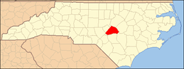 | |
| Towns | ||
| Townships | ||
| CDPs | ||
| Unincorporated communities | ||
| Footnotes | ‡This populated place also has portions in an adjacent county or counties | |