Fizeșu Gherlii
| Fizeșu Gherlii Ördöngösfüzes | |
|---|---|
| Commune | |
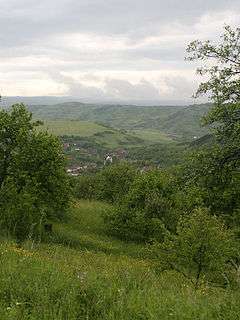 View of Nicula from Nicula Monastery | |
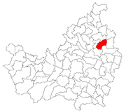 Location in Cluj County | |
 Location on Romania map | |
| Coordinates: 47°01′41″N 23°59′16″E / 47.02806°N 23.98778°ECoordinates: 47°01′41″N 23°59′16″E / 47.02806°N 23.98778°E | |
| Country |
|
| County | Cluj County |
| Status | Commune |
| Settled | 1230 |
| Commune seat | Fizeşu Gherlii |
| Villages | Bonț, Fizeșu Gherlii, Nicula, Săcălaia |
| Government | |
| • Mayor | Ionel Mânecan |
| Area | |
| • Total | 67.1 km2 (25.9 sq mi) |
| Population (July 1, 2007)[1] | |
| • Total | 2,664 |
| • Density | 40/km2 (100/sq mi) |
| Time zone | UTC+2 (EET) |
| • Summer (DST) | UTC+3 (EEST) |
| Area code(s) | +40 x64[2] |
| Website | http://www.cjcluj.ro/fizesu-gherlii/ |
Fizeşu Gherlii (Hungarian: Ördöngösfüzes; German: Teufelswald) is a commune in Cluj County, Romania. It is composed of four villages: Bonț (Boncnyíres), Fizeșu Gherlii, Nicula (Füzesmikola) and Săcălaia (Kisszék).
Demographics
According to the 2011 census, Romanians made up 61.8% of the population, Hungarians made up 21.6% and Roma made up 16.5%.[3]
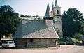 Wooden church in Nicula village
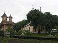 Two churches in Nicula
Notes
- ↑ "Population as of July 1, 2007" (in Romanian). INSSE. April 4, 2008. Archived from the original on April 29, 2008. Retrieved May 4, 2008.
- ↑ x is a digit indicating the operator: 2 for the former national operator, Romtelecom, and 3 for the other ground telephone networks
- ↑ http://www.cluj.insse.ro/cmscluj/files%5Cdeclaratii%5CComunicat%20CLUJ%20-%20DATE%20PROVIZORII%20RPL%202011.pdf%5Bpermanent+dead+link%5D

This article is issued from
Wikipedia.
The text is licensed under Creative Commons - Attribution - Sharealike.
Additional terms may apply for the media files.