Ferguson Township, Clearfield County, Pennsylvania
| Ferguson Township, Clearfield County, Pennsylvania | |
|---|---|
| Township | |
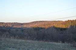 Forests along Cherry Corner Road | |
|
Map of Clearfield County, Pennsylvania highlighting Ferguson Township | |
|
Map of Clearfield County, Pennsylvania | |
| Country | United States |
| State | Pennsylvania |
| County | Clearfield |
| Settled | 1806 |
| Incorporated | 1839 |
| Area[1] | |
| • Total | 26.31 sq mi (68.13 km2) |
| • Land | 26.11 sq mi (67.61 km2) |
| • Water | 0.20 sq mi (0.52 km2) |
| Population (2010) | |
| • Total | 444 |
| • Estimate (2016)[2] | 522 |
| • Density | 20.00/sq mi (7.72/km2) |
| Time zone | UTC-5 (Eastern (EST)) |
| • Summer (DST) | UTC-4 (EDT) |
| Area code(s) | 814 |
| FIPS code | 42-033-25632 |
| Historical population | |||
|---|---|---|---|
| Census | Pop. | %± | |
| 2000 | 410 | — | |
| 2010 | 444 | 8.3% | |
| Est. 2016 | 522 | [2] | 17.6% |
| U.S. Decennial Census[3] | |||
Ferguson Township is a township in Clearfield County, Pennsylvania, United States. The population was 444 at the 2010 census.[4]
Geography
According to the United States Census Bureau, the township has a total area of 23.8 square miles (62 km2), of which, 23.6 square miles (61 km2) of it is land and 0.2 square miles (0.52 km2) of it (0.67%) is water.
Communities
- Gazzam
- Lumber City as of January 6, 2014
- Marron
Demographics
As of the census[5] of 2000, there were 410 people, 158 households, and 114 families residing in the township. The population density was 17.4 people per square mile (6.7/km²). There were 200 housing units at an average density of 8.5/sq mi (3.3/km²). The racial makeup of the township was 99.27% White, 0.24% Asian, 0.24% Pacific Islander, 0.24% from other races.
There were 158 households, out of which 29.7% had children under the age of 18 living with them, 62.0% were married couples living together, 6.3% had a female householder with no husband present, and 27.8% were non-families. 24.7% of all households were made up of individuals, and 11.4% had someone living alone who was 65 years of age or older. The average household size was 2.59 and the average family size was 3.10.
In the township the population was spread out, with 24.9% under the age of 18, 8.0% from 18 to 24, 28.3% from 25 to 44, 22.0% from 45 to 64, and 16.8% who were 65 years of age or older. The median age was 37 years. For every 100 females there were 105.0 males. For every 100 females age 18 and over, there were 106.7 males.
The median income for a household in the township was $30,250, and the median income for a family was $36,625. Males had a median income of $27,841 versus $16,111 for females. The per capita income for the township was $14,337. About 9.9% of families and 11.2% of the population were below the poverty line, including 3.1% of those under age 18 and 19.0% of those age 65 or over.
School Districts
See also
References
- ↑ "2016 U.S. Gazetteer Files". United States Census Bureau. Retrieved Aug 13, 2017.
- 1 2 "Population and Housing Unit Estimates". Retrieved June 9, 2017.
- ↑ "Census of Population and Housing". Census.gov. Retrieved June 4, 2016.
- ↑ Center for New Media and Promotions(C2PO). "2010 Census". census.gov. Archived from the original on 2013-12-21.
- ↑ "American FactFinder". United States Census Bureau. Archived from the original on 2013-09-11. Retrieved 2008-01-31.
Municipalities and communities of Clearfield County, Pennsylvania, United States | ||
|---|---|---|
| City | ||
| Boroughs | ||
| Townships | ||
| CDPs | ||
| Unincorporated communities | ||
| Footnotes | ‡This populated place also has portions in an adjacent county or counties | |
Coordinates: 40°52′00″N 78°36′59″W / 40.86667°N 78.61639°W