Bradford Township, Clearfield County, Pennsylvania
| Bradford Township, Clearfield County, Pennsylvania | |
|---|---|
| Township | |
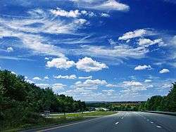 I-80 as it passes through Bradford Township | |
|
Map of Clearfield County, Pennsylvania highlighting Bradford Township | |
|
Map of Clearfield County, Pennsylvania | |
| Country | United States |
| State | Pennsylvania |
| County | Clearfield |
| Incorporated | 1807 |
| Area[1] | |
| • Total | 38.86 sq mi (100.63 km2) |
| • Land | 38.33 sq mi (99.27 km2) |
| • Water | 0.53 sq mi (1.36 km2) |
| Population (2010) | |
| • Total | 3,034 |
| • Estimate (2016)[2] | 2,983 |
| • Density | 77.83/sq mi (30.05/km2) |
| Time zone | UTC-5 (Eastern (EST)) |
| • Summer (DST) | UTC-4 (EDT) |
| Area code(s) | 814 |
| FIPS code | 42-033-08032 |
| Historical population | |||
|---|---|---|---|
| Census | Pop. | %± | |
| 1970 | 2,828 | — | |
| 1980 | 3,374 | 19.3% | |
| 1990 | 2,504 | −25.8% | |
| 2000 | 3,314 | 32.3% | |
| 2010 | 3,034 | −8.4% | |
| Est. 2016 | 2,983 | [2] | −1.7% |
| U.S. Decennial Census[3] | |||
Bradford Township is a township in Clearfield County, Pennsylvania, United States. The population was 3,034 at the 2010 census.[4]
Geography
According to the United States Census Bureau, the township has a total area of 38.8 square miles (100 km2), of which, 38.3 square miles (99 km2) of it is land and 0.5 square miles (1.3 km2) of it (1.29%) is water.
Communities
- Barrett
- Bigler
- Bishtown
- Dale
- Egypt
- Gallows Harbor
- Mineral Springs
- Pine Top
- Pleasant Valley
- Shiloh
- Woodland
Demographics
At the 2000 census,[5] there were 3,314 people, 1,206 households and 963 families residing in the township. The population density was 86.6 people per square mile (33.4/km²). There were 1,296 housing units at an average density of 33.9/sq mi (13.1/km²). The racial makeup of the township was 98.91% White, 0.21% African American, 0.39% Native American, 0.09% Asian, 0.03% from other races, and 0.36% from two or more races. Hispanic or Latino of any race were 0.18% of the population.
There were 1,206 households of which 34.9% had children under the age of 18 living with them, 66.9% were married couples living together, 8.9% had a female householder with no husband present, and 20.1% were non-families. 17.0% of all households were made up of individuals and 8.6% had someone living alone who was 65 years of age or older. The average household size was 2.75 and the average family size was 3.07.
Age distribution was 25.8% under the age of 18, 8.8% from 18 to 24, 28.2% from 25 to 44, 25.4% from 45 to 64, and 11.8% who were 65 years of age or older. The median age was 37 years. For every 100 females, there were 98.0 males. For every 100 females age 18 and over, there were 98.7 males.
The median household income was $32,214 and the median family income was $36,106. Males had a median income of $27,318 versus $20,595 for females. The per capita income for the township was $14,877. About 8.1% of families and 13.1% of the population were below the poverty line, including 20.4% of those under age 18 and 9.6% of those age 65 or over.
School Districts
References
- ↑ "2016 U.S. Gazetteer Files". United States Census Bureau. Retrieved Aug 13, 2017.
- 1 2 "Population and Housing Unit Estimates". Retrieved June 9, 2017.
- ↑ "Census of Population and Housing". Census.gov. Retrieved June 4, 2016.
- ↑ "Archived copy". Archived from the original on 2013-12-21. Retrieved 2015-05-25.
- ↑ "American FactFinder". United States Census Bureau. Archived from the original on 2013-09-11. Retrieved 2008-01-31.
Municipalities and communities of Clearfield County, Pennsylvania, United States | ||
|---|---|---|
| City | ||
| Boroughs | ||
| Townships | ||
| CDPs | ||
| Unincorporated communities | ||
| Footnotes | ‡This populated place also has portions in an adjacent county or counties | |
Coordinates: 41°01′32″N 78°19′08″W / 41.02556°N 78.31889°W