Feleacu
| Feleacu Erdőfelek | |
|---|---|
| Commune | |
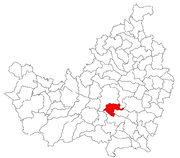 Location in Cluj County | |
 Location on Romania map | |
| Coordinates: 46°42′40″N 23°37′00″E / 46.71111°N 23.61667°E | |
| Country |
|
| County | Cluj County |
| Status | Commune |
| Settled | 1366 |
| Commune seat | Feleacu |
| Villages | Feleacu, Gheorghieni, Vâlcele, Sărădiș, Casele Micești |
| Government | |
| • Mayor | Ioan Tanțău |
| Area | |
| • Total | 61.7 km2 (23.8 sq mi) |
| Population (July 1, 2007)[1] | |
| • Total | 3,810 |
| • Density | 62/km2 (160/sq mi) |
| Time zone | UTC+2 (EET) |
| • Summer (DST) | UTC+3 (EEST) |
| Area code(s) | +40 x64[2] |
| Website | http://www.cjcluj.ro/feleacu/ |
Feleacu (Hungarian: Erdőfelek; German: Fleck) is a commune in Cluj County, Romania. It is composed of five villages: Casele Micești (Kaszoly), Feleacu, Gheorghieni (Györgyfalva), Sărădiș (Seregélyes) and Vâlcele (Bányabükk).
Demographics
According to the 2002 census, the commune's population was of 3,810. Across time, the commune population has evolved as follows:
| Census[3][4] | Ethnical structure | |||||||
|---|---|---|---|---|---|---|---|---|
| Year | Population | Romanians | Hungarians | Germans | Roma | Other | ||
| 1850 | 2,049 | 934 | 976 | 3 | 126 | 10 | ||
| 1880 | 2,312 | 943 | 1,158 | 5 | 206 | |||
| 1890 | 4,423 | 2,873 | 1,432 | 5 | 113 | |||
| 1900 | 4,874 | 3,291 | 1,583 | 0 | ||||
| 1910 | 5,604 | 3,632 | 1,958 | 1 | 13 | |||
| 1920 | 5,397 | 3,723 | 1,674 | 0 | ||||
| 1930 | 5,661 | 3,917 | 1,742 | 1 | 1 | |||
| 1941 | 5,699 | 4,104 | 1,571 | 3 | 21 | |||
| 1956 | 5,787 | 4,192 | 1,581 | 14 | 0 | |||
| 1966 | 5,549 | 4,060 | 1,485 | 1 | 3 | |||
| 1977 | 5,883 | 4,363 | 1,516 | 4 | 0 | |||
| 1992 | 4,116 | 2,971 | 1,137 | 8 | 0 | |||
| 2002 | 3,810 | 2,798 | 974 | 34 | 0 | |||
Infrastructure
- Guyed TV mast for FM-/TV-broadcasting (height: 180 metres) and some lattice towers with directional antennas at 46°42'52"N 23°38'32"E.
Notes
- ↑ "Population as of July 1, 2007" (in Romanian). INSSE. April 4, 2008. Archived from the original on April 29, 2008. Retrieved May 4, 2008.
- ↑ x is a digit indicating the operator: 2 for the former national operator, Romtelecom, and 3 for the other ground telephone networks
- ↑ Varga E. Census statistics in Transylvania, 1850-1992
- ↑ 2002 census data

Coordinates: 46°42′58″N 23°37′06″E / 46.71611°N 23.61833°E
This article is issued from
Wikipedia.
The text is licensed under Creative Commons - Attribution - Sharealike.
Additional terms may apply for the media files.