Federispitz
| Federispitz | |
|---|---|
 | |
| Highest point | |
| Elevation | 1,865 m (6,119 ft) |
| Prominence | 194 m (636 ft) [1] |
| Isolation | 2.85 kilometres (1.77 mi) |
| Parent peak | Speer, Chüemettler |
| Coordinates | 47°9′59.5″N 9°5′23″E / 47.166528°N 9.08972°ECoordinates: 47°9′59.5″N 9°5′23″E / 47.166528°N 9.08972°E |
| Geography | |
 Federispitz Location in Switzerland | |
| Location | St. Gallen, Switzerland |
| Parent range | Appenzell Alps |
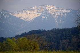
The Federispitz (1,865 m) is a mountain of the Appenzell Alps, overlooking the Walensee in the canton of St. Gallen. It lies south of the Speer.
References
External links
| Wikimedia Commons has media related to Federispitz. |
This article is issued from
Wikipedia.
The text is licensed under Creative Commons - Attribution - Sharealike.
Additional terms may apply for the media files.